Events
The Sustainable and Resilient Communities (SRC) team will host the 2nd Annual Connecticut Regional Funding Workshop on Monday, March 31, 2025 from 10:00 am – 2:30 pm in New Haven, CT to provide information on funding opportunities to support sustainability and resilience-focused projects. The event is free, and lunch will be provided.
Date: Monday, March 31, 2025
Time: 10:00 am – 2:30 pm (lunch will be provided)
Location: Canal Dock Boathouse, 475 Long Wharf Dr, New Haven, CT 06511
Registration is required by March 26th
Attendees will hear from program officers representing various local, state, and regional funding organizations and be able to engage in discussions with funders to explore project ideas and ways to improve funding applications. Attendees will also hear from a panel of successful awardees about their experiences and strategies. The workshop is intended for municipal officials and staff, nonprofits, community organizations, and other groups interested in planning and implementing projects that advance the sustainability and resilience of Long Island Sound communities.
Featured Funding & Assistance Opportunities
Events

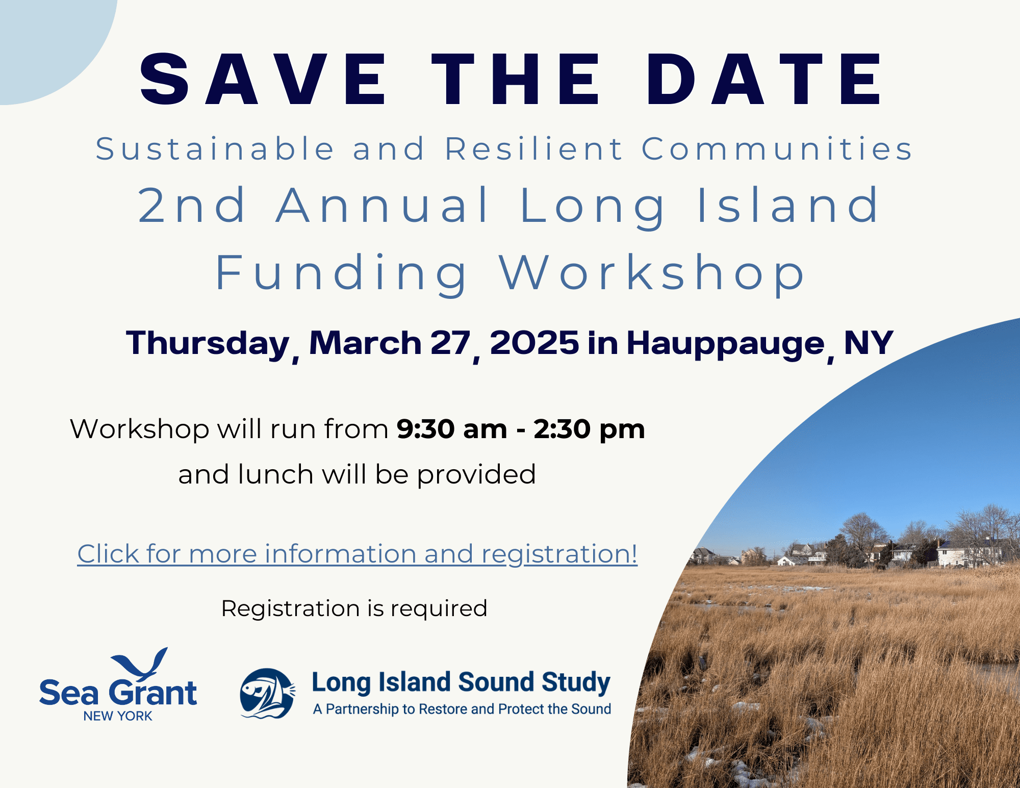
The Sustainable and Resilient Communities (SRC) team will host the 2nd Annual Long Island Regional Funding Workshop to provide information on funding opportunities to support sustainability and resilience projects. The event is free and lunch will be provided.
Date: Thursday, March 27, 2025
Time: 9:30AM – 2:30PM (lunch will be provided)
Location: Hyatt Regency Long Island (1717 Motor Parkway Hauppauge, NY 11788)
Registration is required by March 21st
Attendees will hear from program officers representing various local, state, and Long Island Sound funding organizations and be able to engage in discussions with funders to explore project ideas and ways to improve funding applications. Attendees will also hear from a panel of successful awardees about their experiences and strategies. The workshop is intended for municipal officials and staff, nonprofits, community organizations, and other interested parties.
Featured Funding Opportunities
Email lisresilience@gmail.com with questions.
View the resources and recording from last year’s Long Island Funding Workshop, held on March 28, 2024.
Events

The Sustainable and Resilient Communities (SRC) team will host the 2nd Annual Long Island Regional Funding Workshop to provide information on funding opportunities to support sustainability and resilience projects. The event is free and lunch will be provided.
Date: Thursday, March 27, 2025
Time: 9:30AM – 2:30PM (lunch will be provided)
Location: Hyatt Regency Long Island (1717 Motor Parkway Hauppauge, NY 11788)
Registration is required by March 21st
Attendees will hear from program officers representing various local, state, and Long Island Sound funding organizations and be able to engage in discussions with funders to explore project ideas and ways to improve funding applications. Attendees will also hear from a panel of successful awardees about their experiences and strategies. The workshop is intended for municipal officials and staff, nonprofits, community organizations, and other interested parties.
Featured Funding Opportunities
Email lisresilience@gmail.com with questions.
View the resources and recording from last year’s Long Island Funding Workshop, held on March 28, 2024.
Training

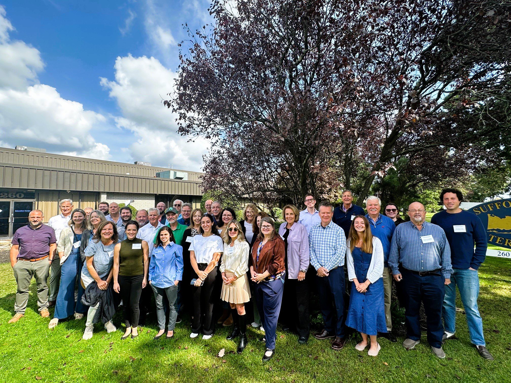
With funding from Long Island Sound Study and support from New York Sea Grant’s Sustainable and Resilient Communities Extension Professionals, Pace University’s Land Use Law Center brought its award-winning Land Use Leadership Alliance Training Program to Suffolk and Nassau municipalities within the Long Island Sound watershed. The training program consisted of three full-day workshops held in Hauppauge, NY that focused on the land use system, innovative approaches to sea level rise adaptation, hazard mitigation, and natural resource protection to strengthen community planning, regulation, and informed decision-making. 28 municipal staff and community leaders, representing 18 different Long Island Sound communities, completed the Program. Program graduates gained new networks of support, identified successful land use techniques, and developed implementation plans that will enable a more resilient future for their community and the Long Island Sound region.
The program comprised three full-day sessions on September 27, October 4, and October 18, 2024 at the Suffolk County Water Authority Education Center, 260 Motor Parkway in Hauppauge, NY.
If you are interested in learning more and participating in a future LULA training, please email lisresilience@gmail.com.
Training

With funding from Long Island Sound Study and support from New York Sea Grant’s Sustainable and Resilient Communities Extension Professionals, Pace University’s Land Use Law Center brought its award-winning Land Use Leadership Alliance Training Program to Suffolk and Nassau municipalities within the Long Island Sound watershed. The training program consisted of three full-day workshops held in Hauppauge, NY that focused on the land use system, innovative approaches to sea level rise adaptation, hazard mitigation, and natural resource protection to strengthen community planning, regulation, and informed decision-making. 28 municipal staff and community leaders, representing 18 different Long Island Sound communities, completed the Program. Program graduates gained new networks of support, identified successful land use techniques, and developed implementation plans that will enable a more resilient future for their community and the Long Island Sound region.
The program comprised three full-day sessions on September 27, October 4, and October 18, 2024 at the Suffolk County Water Authority Education Center, 260 Motor Parkway in Hauppauge, NY.
If you are interested in learning more and participating in a future LULA training, please email lisresilience@gmail.com.
Training
The Long Island Sound Sustainable and Resilient Communities (SRC) Team held our 2024 Annual Workshop virtually as three sessions over two days. Session topics focused on our assistance programs, new regional resilience resources and tools, and a discussion on planning for inundation and different considerations communities may face.
Session 2 – Resilience Tools was held on Tuesday, December 10th from 1:30-3:30 PM. Participants learned about new Resilience Tools being developed and used throughout coastal Long Island Sound.


Events
Join us as we visit the newly constructed living shoreline at Edith Read Sanctuary in Rye, New York. Project leaders from the Westchester County Planning and Parks Departments will guide a tour of the site and share behind-the-scenes project details. Lunch will follow where you will have the opportunity to engage in discussions with local nonprofit and community leaders. This field trip is part of a Community Resilience Project Showcase leading up to our 2024 Annual Sustainable and Resilient Communities Workshop.
Events
Join us as we visit the new bioretention/rain garden project in Hamden’s Town Center Park! Together with Save the Sound and the Town of Hamden, you will tour the site and learn behind-the-scenes project details. Then, you will attend presentations to consider more details and lessons learned, engage in discussions with community leader, and have the opportunity to workshop your own resilience project. This field trip is part of a Community Resilience Project Showcase leading up to our 2024 Annual Sustainable and Resilient Communities (SRC) Workshop.
Mapper
Level of Effort:
Interactive map with county-level disaster declaration information and Congressional Districts for 2011-2023. Also includes a fact sheet and tables.
Mapper
Level of Effort:
Interactive map with county-level disaster declaration information and Congressional Districts for 2011-2023. Also includes a fact sheet and tables.
Plan
Level of Effort:
National Report with State-based County-level data detailing the experiences of communities as a result of climate change. State reports include eight maps that show where major disasters have occurred, where post-disaster support has been given, where the most socially vulnerable populations reside, and the energy reliability by utility area. It also provides county-level disaster data within State Assembly, Senate, and Congressional district boundaries.
Mapper
Level of Effort:
Connecticut EJ Screening Tool is an interactive resource that combines both community and data-driven approach that incorporates environmental burdens and demographic indicators. This map allows users to explore the environmental health and the conditions (socioeconomic and or other distinguishing community characteristics) within a specific region, town, city, and or entire state.
The data included in this map finalize into a score that allows users to understand the relationship between the community and environmental justice. Through the presentation of this information, citizens and policymakers alike can understand what communities are experiencing and form policies that reshape these matters.
Mapper
Level of Effort:
Coastal Resilience is a Connecticut-based decision support tool that provides local, regional, state and national stakeholders a step-wise process to guide decisions to reduce the ecological and socio-economic risks of coastal and inland hazards.
Mapper
Level of Effort:
Coastal Resilience is a Connecticut-based decision support tool that provides local, regional, state and national stakeholders a step-wise process to guide decisions to reduce the ecological and socio-economic risks of coastal and inland hazards.
Plan
Level of Effort:
National Report with State-based County-level data detailing the experiences of communities as a result of climate change. State reports include eight maps that show where major disasters have occurred, where post-disaster support has been given, where the most socially vulnerable populations reside, and the energy reliability by utility area. It also provides county-level disaster data within State Assembly, Senate, and Congressional district boundaries.
Mapper
Level of Effort:
This mapper, developed through the New York Climate Act, was developed by the State Climate Justice Working Group to identify disadvantaged communities to ensure that frontline and otherwise underserved communities benefit from the state’s historic transition to cleaner, greener sources of energy, reduced pollution and cleaner air, and economic opportunities. The interactive map identifies areas throughout the State that meet the disadvantaged community Criteria as defined by the Climate Justice Working Group.
Mapper
Level of Effort:
Use this mapper to visualize people, infrastructure, and natural resources exposed to coastal flood hazards. You can save and share the online maps to communicate with stakeholders. Tip: watch the short video about the tool before getting started!
Mapper
Level of Effort:
Use this mapper to visualize people, infrastructure, and natural resources exposed to coastal flood hazards. You can save and share the online maps to communicate with stakeholders. Tip: watch the short video about the tool before getting started!
Mapper
Level of Effort:
Neighborhoods at Risk is an easy-to-use website with interactive maps, charts, and resources to help communities identify neighborhoods that may be more impacted by climate change. It shows where people may experience unequal impacts from flooding and extreme heat.
Mapper
Level of Effort:
Neighborhoods at Risk is an easy-to-use website with interactive maps, charts, and resources to help communities identify neighborhoods that may be more impacted by climate change. It shows where people may experience unequal impacts from flooding and extreme heat.
Website
Level of Effort:
MyCoast NY collects and catalogs photos provided by volunteers that document changing water levels, shorelines, and hazardous weather impacts across New York’s varied coasts and water bodies. Photos are linked to real-time environmental conditions to create flooding and storm impact reports that help stakeholders like government agencies, business owners, and residents understand our changing environment and make informed decisions.
Website
Level of Effort:
Submit your coastal flooding photos through this website/app. Photos are linked to real-time environmental conditions to create flooding reports that help stakeholders understand our changing environment and make informed decisions.
Website
Level of Effort:
Submit your coastal flooding photos through this website/app. Photos are linked to real-time environmental conditions to create flooding reports that help stakeholders understand our changing environment and make informed decisions.
Mapper
Level of Effort:
RAPT provides access to important data and analysis tools to support your community before, during and after a disaster.
Mapper
Level of Effort:
RAPT provides access to important data and analysis tools to support your community before, during and after a disaster.
Story Map
Level of Effort:
This story map illustrates historical hurricane tracks, strike frequency, and potential areas of coastal flooding and inundation from storms.
Story Map
Level of Effort:
This story map illustrates historical hurricane tracks, strike frequency, and potential areas of coastal flooding and inundation from storms.
Mapper
Level of Effort:
Shows various SLR scenarios and flood event scenarios calibrated for the Long Island Sound CT coast. Also includes FEMA Limit of Moderate Wave Action boundary for referencing building codes.
Mapper
Level of Effort:
Shows various SLR scenarios and flood event scenarios calibrated for the Long Island Sound CT coast. Also includes FEMA Limit of Moderate Wave Action boundary for referencing building codes.
Mapper
Level of Effort:
Shows areas vulnerable to near-term flooding from different combinations of sea level rise, storm surge, tides, and tsunamis, or to permanent submersion by long-term sea level rise. Within the U.S., it incorporates the latest, high-resolution, high-accuracy lidar elevation data supplied by NOAA (exceptions: see Sources), displays points of interest, and contains layers displaying social vulnerability, population density, and property value.
Resources & Tools