
Resilience Steps
Find support and resources tailored to your project needs. Select your Planning Phase, Location, and/or Topic of interest to access a filtered selection of our curated resources and tools.
Find support and resources tailored to your project needs. Select your Planning Phase, Location, and/or Topic of interest to access a filtered selection of our curated resources and tools.

Learn about the environmental threats and climate risks in your community

Identify strategies to help mitigate risks and develop ways to adapt to a changing climate

Find funding and guidance to help put your plans into action

Monitor, maintain, and adaptively-manage your project to sustain success
Select one or more of the filters below to find relevant tools and resources for your needs
Learn how to identify, prioritize, and implement high-impact projects

Training
The Long Island Sound Sustainable and Resilient Communities (SRC) Team held our 2024 Annual Workshop virtually as three sessions over two days. Session topics focused on our assistance programs, new regional resilience resources and tools, and a discussion on planning for inundation and different considerations communities may face.
Session 1 – SRC Resilience Assistance Programs was held on Tuesday, December 10th from 10-11:30 AM. Participants learned about our Sustainable and Resilient Communities resilience assistance programs and heard from communities who have successfully utilized them to advance resilience project plans, build capacity, and secure competitive grant funding!
Training
The Long Island Sound Sustainable and Resilient Communities (SRC) Team held our 2024 Annual Workshop virtually as three sessions over two days. Session topics focused on our assistance programs, new regional resilience resources and tools, and a discussion on planning for inundation and different considerations communities may face.
Session 2 – Resilience Tools was held on Tuesday, December 10th from 1:30-3:30 PM. Participants learned about new Resilience Tools being developed and used throughout coastal Long Island Sound.
Training
The Long Island Sound Sustainable and Resilient Communities (SRC) Team held our 2024 Annual Workshop virtually as three sessions over two days. Session topics focused on our assistance programs, new regional resilience resources and tools, and a discussion on planning for inundation and different considerations communities may face.
Session 3 – Planning for Inundation was held on Wednesday, December 11th from 10 AM-12 PM. Participants heard from communities and regional entities that are using or considering different aspects of planning for inundation, including buyout programs, land use policies, and community perspectives on retreat/relocation.
Training
These webinars were presented by NEIWPCC, Long Island Sound Study, and the New York State Department of Environmental Conservation. The webinars introduced the Marsh Interactive Fate Viewer, discussed the process of creating marsh conservation plans for Westchester County and Mattituck Creek (Suffolk County) in 2021, and laid the groundwork for developing additional marsh conservation plans over the course of 2023.
Training
In this Coastal Resiliency Network webinar, Samantha Klein, Environmental Analyst for the Town of East Hampton, discusses her experience in paving the way to a more resilient East Hampton with the development of their CARP (Coastal Assessment Resiliency Plan). She focuses on lessons learned, funding, and providing guidance on how to get started creating your own CARP. The Coastal Resilience Network, led by the New York State Association of Conservation Commissions (NYSACC) with assistance from NY Sea Grant, is a collaborative open forum for communities in coastal Westchester, Nassau, and Suffolk Counties to discuss and learn about opportunities to increase their resilience to sea level rise, flooding, and extreme events.
Training
This field trip was part of a Community Resilience Project Showcase leading up to the 2024 Annual SRC Workshop.
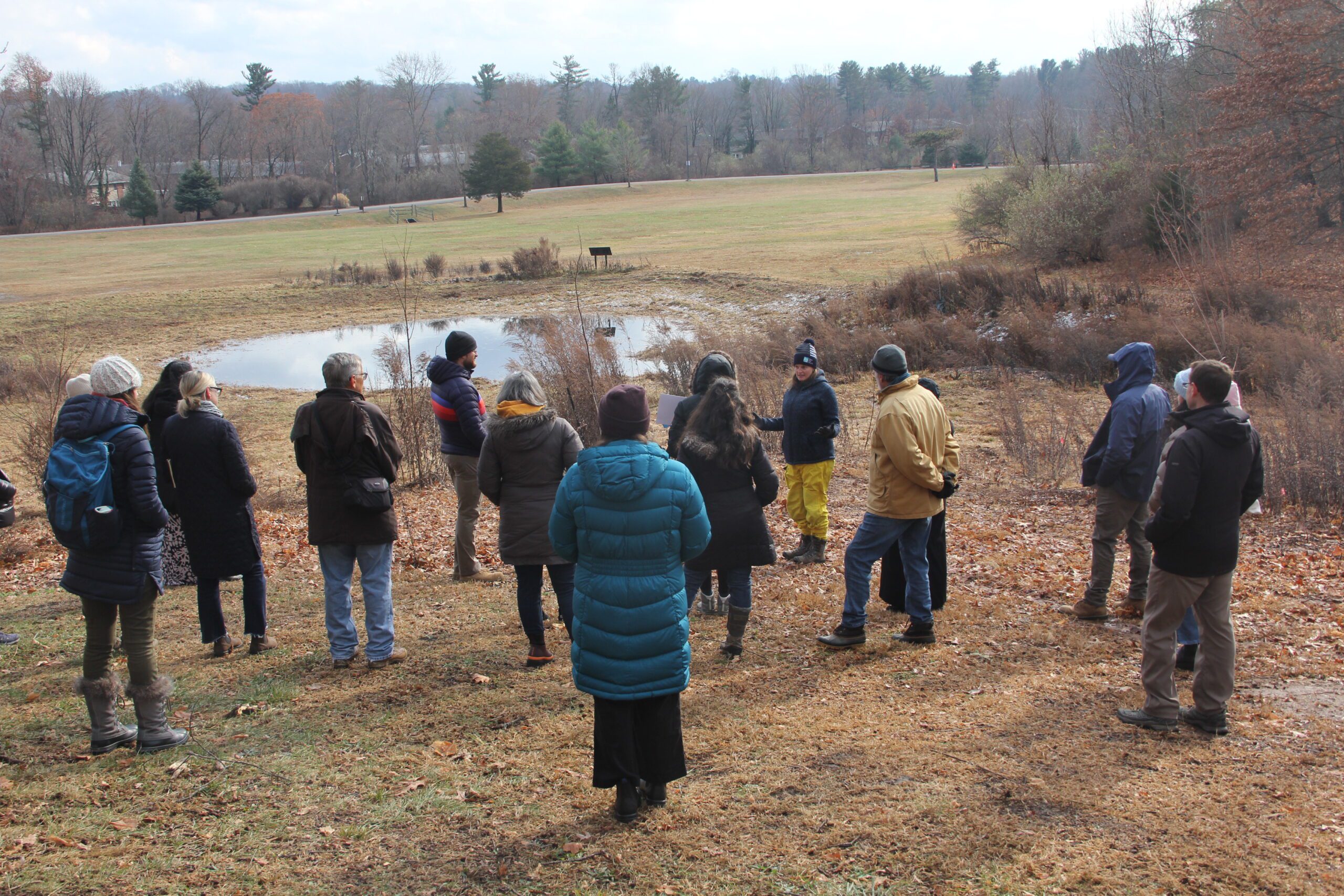 On December 5, 2024, the Sustainable and Resilient Communities (SRC) team of the Long Island Sound Study hosted a field trip featuring the Town of Hamden’s Bioretention Project – the largest municipally owned rain garden in the state! Participants began with a guided tour of the rain garden and bioretention areas at Town Center Park, where they heard from project planners and managers about its history, partnerships, challenges, and maintenance. Following this, participants gathered at the Hamden Government Center for a working lunch and presentations on topics including UConn’s Stormwater Corps, native plants, project engineering, and using nature-based solutions to advance climate resilience goals. The day concluded with a lively group discussion. Special thanks to our partners with the Town of Hamden, Save the Sound, the Hamden Land Trust, and UConn Extension.
Photo credit: Judy Benson
Training
This field trip was part of a Community Resilience Project Showcase leading up to the 2024 Annual SRC Workshop.
On December 5, 2024, the Sustainable and Resilient Communities (SRC) team of the Long Island Sound Study hosted a field trip featuring the Town of Hamden’s Bioretention Project – the largest municipally owned rain garden in the state! Participants began with a guided tour of the rain garden and bioretention areas at Town Center Park, where they heard from project planners and managers about its history, partnerships, challenges, and maintenance. Following this, participants gathered at the Hamden Government Center for a working lunch and presentations on topics including UConn’s Stormwater Corps, native plants, project engineering, and using nature-based solutions to advance climate resilience goals. The day concluded with a lively group discussion. Special thanks to our partners with the Town of Hamden, Save the Sound, the Hamden Land Trust, and UConn Extension.
Photo credit: Judy Benson
Training
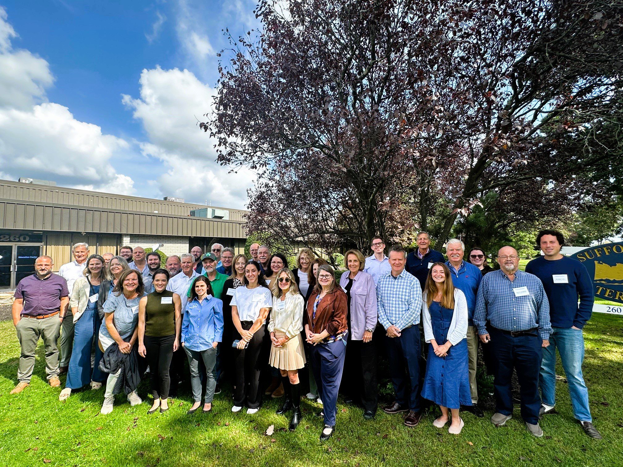
With funding from Long Island Sound Study and support from New York Sea Grant’s Sustainable and Resilient Communities Extension Professionals, Pace University’s Land Use Law Center brought its award-winning Land Use Leadership Alliance Training Program to Suffolk and Nassau municipalities within the Long Island Sound watershed. The training program consisted of three full-day workshops held in Hauppauge, NY that focused on the land use system, innovative approaches to sea level rise adaptation, hazard mitigation, and natural resource protection to strengthen community planning, regulation, and informed decision-making. 28 municipal staff and community leaders, representing 18 different Long Island Sound communities, completed the Program. Program graduates gained new networks of support, identified successful land use techniques, and developed implementation plans that will enable a more resilient future for their community and the Long Island Sound region.
The program comprised three full-day sessions on September 27, October 4, and October 18, 2024 at the Suffolk County Water Authority Education Center, 260 Motor Parkway in Hauppauge, NY.
If you are interested in learning more and participating in a future LULA training, please email lisresilience@gmail.com.
Training
Held at Locust Valley Library in Nassau County on May 4, 2023, this forum brought together state and local decision makers and other stakeholders, working to address coastal erosion along the Long Island Sound shoreline. Panelists highlighted strategies and options to address coastal erosion, discussed the Coastal Erosion Hazard Areas Program, local codes, updated New York State sea level rise projections and more. During small group discussions, attendees discussed challenges and identified opportunities to increase resilience, all in an effort to enhance coordination across communities. This forum was hosted by New York Sea Grant and Long Island Sound Study, in partnership with Nassau County Soil and Water Conservation District.
Training
Held at Port Jefferson Village Center in Suffolk County on May 10, 2023, this forum brought together state and local decision makers and other stakeholders, working to address coastal erosion along the Long Island Sound shoreline. Panelists highlighted strategies and options to address coastal erosion, discussed the Coastal Erosion Hazard Areas Program, local codes, updated New York State sea level rise projections and more. During small group discussions, attendees discussed challenges and identified opportunities to increase resilience, all in an effort to enhance coordination across communities. This forum was hosted by New York Sea Grant and Long Island Sound Study, in partnership with Suffolk County Soil and Water Conservation District and Suffolk County Legislators Sarah Anker, Stephanie Bontempi, Kara Hahn, and Al Krupski.
Case Study
In 2023, Long Island Sound Study and Warren Pinnacle, in partnership with Westchester County and conservation groups/organizations, have developed a Plan to understand the benefits of, threats to, and recommended conservation actions for marsh ecosystems on Glen Island Park in New Rochelle, NY. The goal of the Plan is to help inform conservation and restoration efforts to maximize marsh ecosystem services under rising sea levels.
Sara Powell, slp285@cornell.edu
Case Study
In 2023, Long Island Sound Study and Warren Pinnacle, in partnership with Westchester County and conservation groups/organizations, have developed a Plan to understand the benefits of, threats to, and recommended conservation actions for marsh ecosystems on Glen Island Park in New Rochelle, NY. The goal of the Plan is to help inform conservation and restoration efforts to maximize marsh ecosystem services under rising sea levels.
Training
In this Coastal Resiliency Network webinar, Jess Kuonen from NY Sea Grant presents on MyCoast New York, a portal used to collect and analyze photos of changing water levels, shorelines, and hazardous weather impacts across New York’s varied coasts and water bodies. Additionally, Nelson Vaz from the National Weather Service – NY shared the National Weather Service Coastal Flood Webpage resources and the benefits of collecting local impact information from sources such as MyCoast NY. The Coastal Resilience Network, led by the New York State Association of Conservation Commissions (NYSACC) with assistance from NY Sea Grant, is a collaborative open forum for communities in coastal Westchester, Nassau, and Suffolk Counties to discuss and learn about opportunities to increase their resilience to sea level rise, flooding, and extreme events.
Training
On October 28, 2024, state and local decision makers, municipal staff, and other interested parties working to address coastal issues gathered at the Sands Point Preserve Conservancy in Sands Point, NY to identify opportunities to increase resilience, learn about best practices, and enhance coordination across communities. There were presentations on the Long Island Sound Resilience Resource Hub & Assistance Programs, NYSDEC Office of Climate Change updates, marsh conservation planning, bluff management and restoration, and nature-based solutions to increase shoreline resilience. There was also a guided walking tour of the resilience projects at Sands Point Preserve.
The event is hosted by Long Island Sound Study and New York Sea Grant, in partnership with the Sands Point Preserve Conservancy and Nassau and Suffolk Soil and Water Conservation Districts.
Training
On July 18th, 2023 NYS Department of Environmental Conservation and NY Sea Grant hosted a free public webinar to share more about what steps homeowners can take in their own yards to protect and improve Long Island waters! Featured experts from New York Sea Grant, NYS Department of Environmental Conservation, Long Island Commission for Aquifer Protection, Cornell Cooperative Extension Suffolk County, and Rewild Long Island discussed smart fertilizer practices, water conservation, and native plantings.
Training
The first annual Long Island Sound Bi-State Sustainable and Resilient Communities Workshop brought together more than 260 people virtually on Dec. 1, 2022 to learn about opportunities to increase the resilience of the Sound’s communities to climate change and other environmental threats. Interactive sessions included opportunities to learn more about the SRC Extension Professionals’ needs assessment findings and recommendations, the newly released Long Island Sound Resilience Grant Writing Assistance Program, and tips for success with Long Island Sound funding opportunities. Concurrent breakout sessions highlighted the work of partners related to shoreline planning and implementation, using green infrastructure for stormwater management, sustainable climate planning for relocation, and new sustainability/resilience tools available in both New York and Connecticut. Videos of the workshop’s six sessions are available on YouTube. They can be accessed below along with supporting documents.
Training
The second annual Long Island Sound Bi-State Sustainable and Resilient Communities Workshop brought together nearly 200 people virtually on Dec. 7, 2023 to learn about a new Long Island Sound Resilience Resource Hub (launching in early 2024), hear from communities and groups around the Sound working on resilience planning, and consider pathways for updating codes and ordinances. Videos of the workshop’s six sessions are available on YouTube. They can be accessed below along with supporting documents.
Training
In Spring 2024 the SRC team hosted funding workshops in eastern CT, western CT, Westchester NY, and Long Island NY.
The Sustainable and Resilient Communities (SRC) team held this Regional Funding
Workshop for Eastern Connecticut at UConn Avery Point in Groton, CT. Attendees learned about resilience planning steps and resources, heard from state and local funding organizations, learned about environmental justice considerations, discussed questions with a panel of recent awardees, and had the opportunity to participate in roundtables to strategize improving their applications.
Training
In Spring 2024 the SRC team hosted funding workshops in eastern CT, western CT, Westchester NY, and Long Island NY.
The Sustainable and Resilient Communities (SRC) team held this Regional Funding Workshop for Western Connecticut at Housatonic Community College in Bridgeport, CT. Attendees learned about resilience planning steps and resources, heard from state and local funding organizations, learned about environmental justice considerations, discussed questions with a panel of recent awardees, and had the opportunity to participate in roundtables to strategize improving their applications.
Training
This online information session held Sept. 19, and repeated Sept. 21, provides an introduction to resilience planning in the Long Island Sound region. It includes discussions on local climate impacts and projections, resilience planning strategies, and climate certification programs for both New York and Connecticut municipalities. In addition to the main presentation, videos of the Connecticut and New York breakout sessions can be accessed below. The presentations and other resource materials are available here.
Training
On October 29, 2024, state and local decision makers, municipal staff, and other interested parties working to address coastal issues gathered at the Dorothy P. Flint 4-H Camp in Riverhead, NY to identify opportunities to increase resilience, learn about best practices, and enhance coordination across communities. There were presentations on the Long Island Sound Resilience Resource Hub, NYSDEC Climate Office updates, marsh conservation planning, bluff management and restoration, and nature-based solutions to increase shoreline resilience. There was also a field trip to Iron Pier Beach/Maidstone Landing to view and learn about a community bluff restoration project.
This event was hosted by Long Island Sound Study and New York Sea Grant, in partnership with Nassau and Suffolk Soil and Water Conservation Districts, Nassau CCE, and Maidstone Landing.
Guidance Tool
Level of Effort:
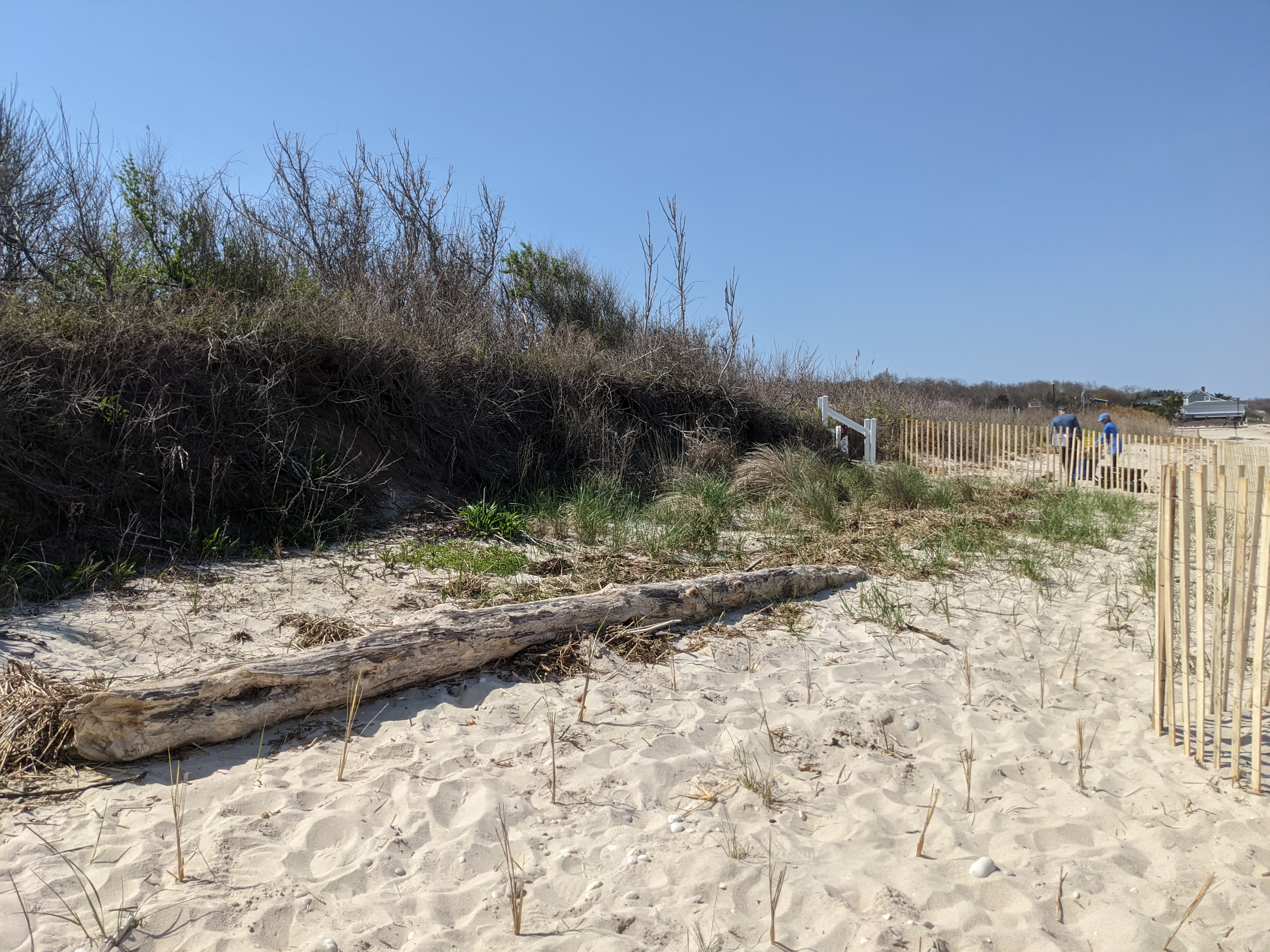
Website (also available as a PDF) to help coastal property owners evaluate threats to beaches and dunes and consider potential solutions. It includes background information on dune systems, and how to identify shoreline erosion.
Guidance Tool
Level of Effort:
Website (also available as a PDF) to help coastal property owners evaluate threats to beaches and dunes and consider potential solutions. It includes background information on dune systems, and how to identify shoreline erosion.
Guidance Tool
Level of Effort:
Provides resources that help Connecticut’s municipal leaders fill gaps in local
extreme heat planning including
1. Communication templates
2. Cooling center best practices
3. A diverse collection of policy and planning actions
4. Advice on creating a heat response plan
Also provides Connecticut-specific information on how extreme heat impacts the
health of residents, especially vulnerable people, and extreme heat safety tips.
Website
Level of Effort:
A platform with resources by state for brownfield remediation, resilience, and sustainable redevelopment.
Website
Level of Effort:
A platform with resources by state for brownfield remediation, resilience, and sustainable redevelopment.
Website
Level of Effort:
A website and a downloadable app for your mobile device. The resource has information about rain gardens, designing, selecting plants, and installing a garden on your property.
Website
Level of Effort:
A website and a downloadable app for your mobile device. The resource has information about rain gardens, designing, selecting plants, and installing a garden on your property.
Guidance Tool
Level of Effort:
CT state resource on living shorelines, with a few good fact sheets and pages about types of living shoreline techniques and permitting for our state. There is also a list of pilot projects in CT.
Guidance Tool
Level of Effort:
CT state resource on living shorelines, with a few good fact sheets and pages about types of living shoreline techniques and permitting for our state. There is also a list of pilot projects in CT.
Mapper
Level of Effort:
Shows areas vulnerable to near-term flooding from different combinations of sea level rise, storm surge, tides, and tsunamis, or to permanent submersion by long-term sea level rise. Within the U.S., it incorporates the latest, high-resolution, high-accuracy lidar elevation data supplied by NOAA (exceptions: see Sources), displays points of interest, and contains layers displaying social vulnerability, population density, and property value.
Guidance Tool
Level of Effort:
This booklet from the EPA and CDC summarizes why extreme heat is on the rise, how it might affect people, and outlines steps to prepare for extreme heat events to reduce health risks.
Guidance Tool
Level of Effort:
This booklet from the EPA and CDC summarizes why extreme heat is on the rise, how it might affect people, and outlines steps to prepare for extreme heat events to reduce health risks.
Guidance Tool
Level of Effort:
This document offers foundational learning opportunities for the emergency management community and beyond. By sharing communication techniques, climate information, data resources, and guidance for connecting with experts, this resource helps advance the integration of climate change considerations into actionable efforts before, during, and after disasters.
Mapper
Level of Effort:
Connecticut EJ Screening Tool is an interactive resource that combines both community and data-driven approach that incorporates environmental burdens and demographic indicators. This map allows users to explore the environmental health and the conditions (socioeconomic and or other distinguishing community characteristics) within a specific region, town, city, and or entire state.
The data included in this map finalize into a score that allows users to understand the relationship between the community and environmental justice. Through the presentation of this information, citizens and policymakers alike can understand what communities are experiencing and form policies that reshape these matters.
Website
Level of Effort:
The Connecticut Invasive Plant Working Group website has information on events, invasive plant information for Connecticut, and control information. The mission of the Connecticut Invasive Plant Working Group is to gather and convey information on the presence, distribution, ecological impacts, and management of invasive species; to promote uses of native or non-invasive ornamental alternatives throughout Connecticut; and to work cooperatively with researchers, conservation organizations, government agencies, green industries, and the general public to identify and manage invasive species pro-actively and effectively. Organized in 1997 as an ad-hoc group, the Connecticut Invasive Plant Working Group (CIPWG) meets 1 to 2 times per year to collaborate and share information about invasive plant issues affecting Connecticut and the region. The group includes federal, state, and town agency staff, researchers, nursery growers, educators, master gardeners, community members, and interested citizens.
Guidance Tool
Level of Effort:
This Guide provides planning tools, regulatory information, and best management practices to jumpstart shellfish restoration-based project planning.
Guidance Tool
Level of Effort:
This Guide provides planning tools, regulatory information, and best management practices to jumpstart shellfish restoration-based project planning.
Website
Level of Effort:
The Connecticut Shoreline Change Project analyzes how the Connecticut shoreline has changed between the late 1800’s and 2006 through loss (erosion) and gain (accretion) over time.
Website
Level of Effort:
The Connecticut Shoreline Change Project analyzes how the Connecticut shoreline has changed between the late 1800’s and 2006 through loss (erosion) and gain (accretion) over time.
Guidance Tool
Level of Effort:
Resource guide for CT shellfish and aquaculture. It provides information and tools about all things shellfish and aquaculture in Connecticut with sections for businesses, consumers, recreational shellfishing, and shellfish restoration.
Guidance Tool
Level of Effort:
Resource guide for CT shellfish and aquaculture. It provides information and tools about all things shellfish and aquaculture in Connecticut with sections for businesses, consumers, recreational shellfishing, and shellfish restoration.
Resource
Level of Effort:
This fact sheet for Conservation Commissions in Connecticut reviews the role of these commissions for enhancing the climate resilience of their communities. The resource was developed by CIRCA and covers the authority and duties of conservation commissions as well as detailing specific strategies and approaches.
Story Map
Level of Effort:
This EPA StoryMap communicates the importance, history, and threats of Long Island Sound eelgrass meadows. It highlights Long Island Sound Study’s ongoing efforts to protect and restore these essential ecosystems, and emphasizes the importance of understanding climate change implications on eelgrass distribution and productivity.
Story Map
Level of Effort:
This Story map illustrates climate change projections, considering scenarios that factor in temperature, precipitation, extreme heat, storms, and sea level.
Story Map
Level of Effort:
This Story map illustrates climate change projections, considering scenarios that factor in temperature, precipitation, extreme heat, storms, and sea level.
Guidance Tool
Level of Effort:
The Equitable Resilience Builder (ERB) is an application that supports communities in resilience planning with a focus on equity. It engages users in a guided process to inclusively assess local hazards, equity, and the resilience of built, natural, and social environment systems. Results can be used to collaboratively prioritize actions to build community resilience in an equitable way.
Story Map
Level of Effort:
This story map illustrates historical hurricane tracks, strike frequency, and potential areas of coastal flooding and inundation from storms.
Story Map
Level of Effort:
This story map illustrates historical hurricane tracks, strike frequency, and potential areas of coastal flooding and inundation from storms.
Guidance Tool
Level of Effort:
An overview of the processes that cause bluff erosion and how to mitigate erosion.
Guidance Tool
Level of Effort:
An overview of the processes that cause bluff erosion and how to mitigate erosion.
Mapper
Level of Effort:
The FEMA Flood Map Service Center (MSC) is the official public source for flood hazard information produced in support of the National Flood Insurance Program (NFIP). Use the MSC to find your official flood map.
Mapper
Level of Effort:
The FEMA Flood Map Service Center (MSC) is the official public source for flood hazard information produced in support of the National Flood Insurance Program (NFIP). Use the MSC to find your official flood map.
Resource
Level of Effort:
This workbook made by Groundwork Bridgeport provides a thorough but accessible introduction to green stormwater infrastructure. The workbook explains the issues that green infrastructure can help solve, introduces several green infrastructure methods, and then provides definitions, explains why each is uses, and details how to build them.
Resource
Level of Effort:
Use this fact sheet to learn about riparian buffers and how they can be a tool for filtering excess nutrients and sediment from runoff, reducing flood impacts, and providing habitat. Learn more about buffers using this fact sheet. Details include what buffers are, why they are important, best practice recommendations, and design considerations.
Data
Level of Effort:
Provides the most up-to-date sea level rise projections for all U.S. states and territories, out to the year 2150. Extrapolations of available tide gauge observations are also provided. The sea level scenarios and information contained in this tool originate from 2022 technical report produced by the Sea Level Rise and Coastal Flood Hazard Scenarios and Tools Interagency Task Force.
Guidance Tool
Level of Effort:
Keep Forests Healthy: A Tool to Assess Resilience, Health & Productivity was developed by Cornell Cooperative Extension, the Northern Institute of Applied Climate Science, and The Nature Conservancy Central and Western New York Chapter to enable landowners to assess how their forest may be affected by changing climate conditions. This tool can help landowners identify potential risks to forests and highlight forest management options that may increase the ability of a forest to cope with the pressure of changing conditions. The document identifies 16 characteristics that may increase or decrease the risk of harm to a forest in a changing climate, which can then be discussed with a professional to plan forest management activities.
Guidance Tool
Level of Effort:
New York Sea Grant (NYSG) created a new “Protecting Coastal Bluffs of Long Island” Sign (pdf) that is available for municipalities, community groups, homeowner associations and property owners to print and install next to your bluff. NYSG has created a post card version of “Protecting Coastal Bluffs of Long Island” (pdf) available for distribution.
Website
Level of Effort:
Submit your coastal flooding photos through this website/app. Photos are linked to real-time environmental conditions to create flooding reports that help stakeholders understand our changing environment and make informed decisions.
Website
Level of Effort:
Submit your coastal flooding photos through this website/app. Photos are linked to real-time environmental conditions to create flooding reports that help stakeholders understand our changing environment and make informed decisions.
Website
Level of Effort:
MyCoast NY collects and catalogs photos provided by volunteers that document changing water levels, shorelines, and hazardous weather impacts across New York’s varied coasts and water bodies. Photos are linked to real-time environmental conditions to create flooding and storm impact reports that help stakeholders like government agencies, business owners, and residents understand our changing environment and make informed decisions.
Data
Level of Effort:
Assess your county’s exposure and resilience to flooding and the potential economic impacts.
Data
Level of Effort:
Assess your county’s exposure and resilience to flooding and the potential economic impacts.
Website
Level of Effort:
The 2022 State Climate Summaries provide new information on assessment topics directly related to NOAA’s mission, specifically historical climate variations and trends, future climate model projections of climate conditions during the 21st century, and past and future conditions of sea level and coastal flooding. Select your state to find state-level information for observed changes in climate, including both long-term trends and extreme weather events.
Story Map
Level of Effort:
This story map examines the coastal processes and hazards of Long Island and provides options for sustainable and resilient shoreline management. Information is useful for coastal managers, planners and coastal property owners.
Story Map
Level of Effort:
This story map examines the coastal processes and hazards of Long Island and provides options for sustainable and resilient shoreline management. Information is useful for coastal managers, planners and coastal property owners.
Guidance Tool
Level of Effort:
Inclusive community engagement is essential for successful environmental decision-making. The New York State Climate Smart Communities Program seeks to guide local governments in their community engagement efforts, particularly for inclusion of Disadvantaged Communities (DAC). Only through the leadership of those most affected by the climate crisis and environmental pollution can environmental and climate justice be achieved.
Mapper
Level of Effort:
This mapper, developed through the New York Climate Act, was developed by the State Climate Justice Working Group to identify disadvantaged communities to ensure that frontline and otherwise underserved communities benefit from the state’s historic transition to cleaner, greener sources of energy, reduced pollution and cleaner air, and economic opportunities. The interactive map identifies areas throughout the State that meet the disadvantaged community Criteria as defined by the Climate Justice Working Group.
Data
Level of Effort:
New York State sea level rise projections. The New York State Department of Environmental Conservation is currently updating these projections.
Data
Level of Effort:
New York State sea level rise projections. The New York State Department of Environmental Conservation is currently updating these projections.
Mapper
Level of Effort:
This interactive map provides information on boat ramps and saltwater fishing access points on Long Island in Nassau and Suffolk Counties.
Mapper
Level of Effort:
This interactive map provides information on boat ramps and saltwater fishing access points on Long Island in Nassau and Suffolk Counties.
Mapper
Level of Effort:
This NYSDEC tool provides information on shellfish closures in NY’s marine waters and can be used to help resource users understand where it is safe to harvest to shellfish.
Mapper
Level of Effort:
This NYSDEC tool provides information on shellfish closures in NY’s marine waters and can be used to help resource users understand where it is safe to harvest to shellfish.
Website
Level of Effort:
Information from the NYS Department of Health (DOH) on extreme heat impacts and resources for the public.
Website
Level of Effort:
Information from the NYS Department of Health (DOH) on extreme heat impacts and resources for the public.
Guidance Tool
Level of Effort:
The purpose of this fact sheet is to assist landowners in identifying and understanding the primary causes and processes responsible for erosion.
Guidance Tool
Level of Effort:
The purpose of this fact sheet is to assist landowners in identifying and understanding the primary causes and processes responsible for erosion.
Guidance Tool
Level of Effort:
This fact sheet is intended to assist landowners in understanding the various shoreline management options and considerations for their shoreline.
Guidance Tool
Level of Effort:
This fact sheet is intended to assist landowners in understanding the various shoreline management options and considerations for their shoreline.
Report
Level of Effort:
Community-driven relocation describes a situation where a community decides it will relocate,
in whole or in part, to reduce the risk faced by communities and individuals. This Community-Driven Relocation Subcommittee report provides background on community-driven relocation, an
overview of the current federal legal and programmatic landscape, and potential next steps that
Federal agencies can take, as part of a whole-of-government approach, to support communities
contemplating relocation.
Mapper
Level of Effort:
Data shows polygon locations of Potential Environmental Justice Areas (PEJA). PEJA’s have been identified based on data from the 2014-2018 5-year American Community Survey (ACS), conducted by the US Census Bureau. Environmental justice efforts focus on improving the environment in communities, specifically minority and low-income communities, and addressing disproportionate adverse environmental impacts that may exist in those communities. The designated areas are considered for additional outreach within the permitting process, for grant eligibility, and for targeted enforcement of Environmental Conservation Law violations.
Mapper
Level of Effort:
Interactive map with county-level disaster declaration information and Congressional Districts for 2011-2023. Also includes a fact sheet and tables.
Mapper
Level of Effort:
Interactive map with county-level disaster declaration information and Congressional Districts for 2011-2023. Also includes a fact sheet and tables.
Plan
Level of Effort:
National Report with State-based County-level data detailing the experiences of communities as a result of climate change. State reports include eight maps that show where major disasters have occurred, where post-disaster support has been given, where the most socially vulnerable populations reside, and the energy reliability by utility area. It also provides county-level disaster data within State Assembly, Senate, and Congressional district boundaries.
Website
Level of Effort:
ReduceFloodRisk.org was developed by the Association of State Floodplain Managers to help property owners and buyers in flood prone areas identify strategies to reduce their properties risk of flooding.
Website
Level of Effort:
ReduceFloodRisk.org was developed by the Association of State Floodplain Managers to help property owners and buyers in flood prone areas identify strategies to reduce their properties risk of flooding.
Mapper
Level of Effort:
The River Revival Project Map is a GIS-based map that identifies every river and stream in Nassau and Suffolk Counties. It also identifies the tributaries where river herring runs are known to exist, and shows all existing, planned or proposed connectivity projects on the island. The map is intended to be a tool to engage citizens in the restoration of rivers and streams in their communities.
Mapper
Level of Effort:
Save the Sound’s Sound Health Explorer displays information on water quality for Long Island Sound beaches, embayments, and open waters.
Mapper
Level of Effort:
Save the Sound’s Sound Health Explorer displays information on water quality for Long Island Sound beaches, embayments, and open waters.
Resource
Level of Effort:
Municipalities are encouraged to use the Sound Ideas for Clean Water brochure in their outreach efforts. The website and brochure outline steps that residents can take to reduce stormwater runoff that can cause pollution and flooding. For more information about this campaign, contact the outreach coordinator for your area (listed here).
Plan
Level of Effort:
Suffolk County and the local governments within Suffolk County developed a FEMA approved Hazard Mitigation Plan, which documents risks from natural hazards and strategies to mitigate hazards.
Plan
Level of Effort:
Suffolk County and the local governments within Suffolk County developed a FEMA approved Hazard Mitigation Plan, which documents risks from natural hazards and strategies to mitigate hazards.
Mapper
Level of Effort:
In cities across America, trees have historically been planted along race and class lines. Ensuring equitable tree cover across every neighborhood can help address social inequities so that all people can thrive. The map shows your city or town’s current Tree Equity Score and how it can be improved. Each score is calculated using a science-based approach and readily available data from a variety of sources.
Website
Level of Effort:
NOAA overview of living shorelines and their benefits, steps to construction. There is a good map of places where they have been constructed around the US. It is a good place to get basic info about living shorelines, with appropriate links to more specific information like how to get a permit
Story Map
Level of Effort:
This Story Map was developed to provide an overview of the Westchester County Multi-Jurisdictional Hazard Mitigation Plan (HMP) to facilitate county-wide access to the plan. The Westchester County HMP was developed to provide a roadmap to resilience by identifying hazards affecting the county and its communities.
Website
Level of Effort:
Click through all the pages to find guidance on native vs non-native plants, where to buy native plants in Westchester, how to guides, and local ordinances.
Website
Level of Effort:
Click through all the pages to find guidance on native vs non-native plants, where to buy native plants in Westchester, how to guides, and local ordinances.
Guidance Tool
Level of Effort:
This guide is designed to assist decision makers and coastal professionals with applying and integrating the information in the 2022 Sea Level Rise Technical Report, produced by the Sea Level Rise and Coastal Flood Hazard Scenarios and Tools Interagency Task Force, into local sea level rise planning and adaptation decisions.
Mapper
Level of Effort:
Water quality is strongly related to land use. New high-resolution land cover data for Connecticut has made it possible to look at the land/water connection at a finer scale than ever before. Using the three sections of this website below, you can learn about our study, explore the landscape surrounding the over 4,300 local waterways in our state and the implications for the health of these waterways, and test out landscape change scenarios to see what effects they might have.
Guidance Tool
Level of Effort:
This website provides an overview of each chapter of Connecticut’s new Stormwater Quality Manual, which includes guidance on how to design, install, and maintain these types of practices.
Guidance Tool
Level of Effort:
This website provides an overview of each chapter of Connecticut’s new Stormwater Quality Manual, which includes guidance on how to design, install, and maintain these types of practices.
Mapper
Level of Effort:
This resource provides a variety of Aquaculture geodata in CT and can be used to support the decision-making process for aquaculture permitting applications, but does not include authoritative content.
Mapper
Level of Effort:
This resource provides a variety of Aquaculture geodata in CT and can be used to support the decision-making process for aquaculture permitting applications, but does not include authoritative content.
Mapper
Level of Effort:
To better understand how Connecticut’s coastal area marshes and roads may respond to sea level rise (SLR), Sea Level Affecting Marshes Model (SLAMM) was applied to Connecticut’s shoreline by Warren Pinnacle Consulting, Inc. This viewer displays the model’s results for Connecticut’s 21 largest marshes and all coastal area roads. For marshes, SLAMM was run two hundred times using alternative model inputs for key model parameters, including various SLR scenarios, to produce probability based results of likely future marsh conditions. For roads, the model uses a single SLR scenario of about 4.2 feet by 2100 from the base year of 2002. The Sea Level Rise Effects on Roads and Marshes projects is a project between CT DEEP and UConn CLEAR.
Mapper
Level of Effort:
The site includes updated design storm rainfall amounts. Includes estimates of extreme rainfall for various durations (from 5 minutes to 10 days) and recurrence intervals (1 year to 500 years). Regional extreme rainfall maps and graphic products are also available. This updates existing analyses to account for changes such as the increasing frequency of heavy rainfall events.
Mapper
Level of Effort:
The purpose of the Long Island Sound Blue Plan is to identify and protect places of traditional use and ecological significance, and to minimize conflicts, now and in the future. Contains data layers with policy and planning areas, ecologically significant areas, and significant human use areas.
Guidance Tool
Level of Effort:
Healthy ecosystems provide a wide range of benefits, from recreational opportunities to storm surge protection. These benefits are often referred to as ecosystem services. Understanding how changes to the ecosystem may affect these benefits should play a role in the community’s decision making process. This page provides a guide to learning more and key NOAA Digital Coast resources useful for this task.
Mapper
Level of Effort:
The Sea Level Affecting Marshes Model, or SLAMM, uses digital data and other information to simulate potential impacts of long-term sea level rise on wetlands and shorelines. Additional data related to dike locations or other protected areas, accretion rates, erosion rates, and other factors can be included within the model as optional factors. Requires ArcGIS for viewing outputs in a mapping environment and software, such as Microsoft Excel and Word, to view the text and tabular output.
Data
Level of Effort:
The Long Island Tidal Wetlands Trends Analysis measures wetlands loss and changes in marsh condition within the Long Island Sound, Peconic, and South Shore estuaries including all or parts of Westchester, Bronx, Queens, Nassau, and Suffolk Counties between 1974 and 2005/2008. The results of this project are intended for use by environmental managers, conservation advocates and elected officials across a variety of regulatory agencies, environmental organizations, and governments.
Guidance Tool
Level of Effort:
The New York State Department of State worked with the Department of Environmental Conservation and other partners to create model local laws to help local governments be more resilient to sea-level rise, storm surge, and flooding. Cities, towns, and villages are invited to adapt model local laws to meet the resilience needs of the community with the assistance of their municipal attorneys.
Guidance Tool
Level of Effort:
This document developed in support of the NYS Community Risk and Resiliency Act 1) Describes natural resilience measures and how they can be used to mitigate the risks of flooding and erosion, 2) Provides definitions for different types of natural resilience measures and distinguishes among conserved, restored, nature-based and hard structural approaches, 3) Provides information on the value and benefits of using natural resilience measures, along with information on the co-benefits they provide, 4) Lists key factors to consider in the restoration, design and construction of natural resilience measures, and 5) Provides background to support the development of NYS agency guidance on natural resilience measures in the future
Guidance Tool
Level of Effort:
Guidance and training modules for Connecticut Zoning changes to address climate vulnerabilities. On the website there are examples of zoning policies municipalities could modify and/or adopt to enhance local climate resilience. Where applicable, model ordinances and examples of where the policies have been adopted are included.
Mapper
Level of Effort:
This mapper is intended to provide federal, state, and local managers with tools to estimate the vulnerability and ecosystem service potential of wetlands. It allows you to display information on the unvegetated to vegetated ratio (UVVR), marsh elevation, tidal range, and shoreline change rates for New York’s tidal wetlands.
Guidance Tool
Level of Effort:
Aimed at municipalities, this website provides workshop materials and legal issue fact sheets on topics relating to climate adaptation, including living shorelines, flooding, liability, shoreline boundaries, and more.
Guidance Tool
Level of Effort:
Aimed at municipalities, this website provides workshop materials and legal issue fact sheets on topics relating to climate adaptation, including living shorelines, flooding, liability, shoreline boundaries, and more.
Website
Level of Effort:
CLEAR, a program of UConn’s College of Agriculture, Health, and Natural Resources, provides information, education, and assistance to land use decision makers, in support of balancing growth and natural resource protection.
Website
Level of Effort:
CLEAR, a program of UConn’s College of Agriculture, Health, and Natural Resources, provides information, education, and assistance to land use decision makers, in support of balancing growth and natural resource protection.
Mapper
Level of Effort:
This web mapping application displays Water Quality Plans (TMDLs) developed by the 303 (d) program in conjunction with Water Quality Assessments conducted by the 305 (b) program.
Mapper
Level of Effort:
This web mapping application displays Water Quality Plans (TMDLs) developed by the 303 (d) program in conjunction with Water Quality Assessments conducted by the 305 (b) program.
Mapper
Level of Effort:
Connecticut Environmental Conditions Online (CT ECO) is the collaborative work of the Connecticut Department of Energy and Environmental Protection (DEEP) and the University of Connecticut Center for Land Use Education and Research (CLEAR) to share environmental and natural resource information with the general public. CT ECO’s mission is to encourage, support, and promote informed land use and development decisions in Connecticut by providing local, state and federal agencies, and the general public with convenient access to the most up-to-date and complete natural resource information available statewide.
CT ECO includes a variety of online maps and tools for viewing Connecticut’s environmental and natural resources as well as high resolution aerial imagery, elevation data, and land cover. The Advanced Map Viewer provides flexibility to turn on and off layers of the map.
Mapper
Level of Effort:
The Long Island Sound Watershed Land Cover Viewer contains all dates of land cover as well as Change To, Change From, Riparian Area Land Cover, and Impervious Surface Estimate layers. It also has many layers where HUC 12 watersheds are colored based on a single land cover.
Mapper
Level of Effort:
The Long Island Sound Watershed Land Cover Viewer contains all dates of land cover as well as Change To, Change From, Riparian Area Land Cover, and Impervious Surface Estimate layers. It also has many layers where HUC 12 watersheds are colored based on a single land cover.
Mapper
Level of Effort:
This interactive map can help you find your way to over 350 diverse shoreline sites in Connecticut that provide a variety of opportunities for coastal enjoyment.
Mapper
Level of Effort:
This interactive map can help you find your way to over 350 diverse shoreline sites in Connecticut that provide a variety of opportunities for coastal enjoyment.
Guidance Tool
Level of Effort:
Provides information about coastal hazard management in Connecticut including steps for developing plans and responses.
Guidance Tool
Level of Effort:
Provides information about coastal hazard management in Connecticut including steps for developing plans and responses.
Guidance Tool
Level of Effort:
A centralized source of information for municipal officials, coastal property owners, state coastal managers, and the general public on coastal hazards in Connecticut.
Guidance Tool
Level of Effort:
A centralized source of information for municipal officials, coastal property owners, state coastal managers, and the general public on coastal hazards in Connecticut.
Website
Level of Effort:
Contains guidance documents and information on coastal permitting from the State of Connecticut.
Website
Level of Effort:
Contains guidance documents and information on coastal permitting from the State of Connecticut.
Mapper
Level of Effort:
Connecticut-specific site with maps, data, and visualization tools. Contains: Blue Plan, MS4 Viewer, CT Parcel Viewer, Sea Level Rise Effects on Roads & Marshes, CT DEEP Fish Community Data – Inland Waters, CT Aquaculture Mapping Atlas, CT Coastal Hazards Viewer, Carbon Stock & Land Cover Viewer
Mapper
Level of Effort:
The Connecticut Housing Data Hub provides users the ability to explore several categories of state- and town-wide housing data over time. Available data on the dashboard includes permitting, housing stock, rent burden, and housing programs.
Mapper
Level of Effort:
The Connecticut Housing Data Hub provides users the ability to explore several categories of state- and town-wide housing data over time. Available data on the dashboard includes permitting, housing stock, rent burden, and housing programs.
Plan
Level of Effort:
This study by Seth et al. provides up-to-date information on observed trends and projections of temperature and precipitation in Connecticut.
Plan
Level of Effort:
This study by Seth et al. provides up-to-date information on observed trends and projections of temperature and precipitation in Connecticut.
Mapper
Level of Effort:
The Map Viewer is the state’s first geospatial collection of key ecological, biological, and human-use data intended to assess the viability of a coastal location to support shellfish restoration. Further, qualitative oyster habitat surveys characterize, for the first time, the condition of intertidal oyster populations across the state and establish a baseline to inform the planning of future quantitative assessments.
Mapper
Level of Effort:
This mapper provides a view of estuary data and the option to retrieve and save information about water quality, nutrients, land use, etc. There are also instructions provided to assist with usage.
Mapper
Level of Effort:
This mapper provides a view of estuary data and the option to retrieve and save information about water quality, nutrients, land use, etc. There are also instructions provided to assist with usage.
Guidance Tool
Level of Effort:
Includes information about preparing for, and implementing green infrastructure with helpful links to other fact sheets and resources.
Guidance Tool
Level of Effort:
Includes information about preparing for, and implementing green infrastructure with helpful links to other fact sheets and resources.
Guidance Tool
Level of Effort:
FEMA’s National Resilience Guidance document is intended to help all individuals, communities, and organizations understand our nation’s vision for resilience, the key principles that must be applied to strengthen resilience, and the players and systems that contribute to resilience. It also outlines how to strengthen resilience by organizing and engaging people, incorporating resilience concepts into planning efforts, creating change through policies, prioritizing projects and programs, financing resilience efforts, and measuring and evaluating resilience. Finally, the NRG includes a Resilience Maturity Model that illustrates stages in the evolution of a community’s approach to resilience.
Mapper
Level of Effort:
These community profiles are intended to be used by municipal officials and planners working to make their communities more economically, environmentally, and socially resilient. Includes datasets related to FEMA disaster and non-disaster funding, flood insurance claims, social vulnerability, and other community stats.
Mapper
Level of Effort:
RAPT provides access to important data and analysis tools to support your community before, during and after a disaster.
Mapper
Level of Effort:
RAPT provides access to important data and analysis tools to support your community before, during and after a disaster.
Guidance Tool
Level of Effort:
The Federal Highway Administration (FHWA’s) Vulnerability Assessment and Adaptation Framework, 3rd Edition, is a guide and collection of resources for use in analyzing the impacts of climate change and extreme weather on transportation infrastructure. Its purpose is to identify key considerations, questions, and resources that can be used to design and implement a climate change vulnerability assessment. The processes, lessons learned, and resources outlined in the framework are geared toward state departments of transportation (DOTs), metropolitan planning organizations (MPOs), and other agencies involved in planning, building, or maintaining the transportation system. It includes suggestions and examples applicable to a wide range of applications, from small qualitative studies to large, detailed, data-intensive analyses. The resources included in the framework will be added to and updated over time.
Guidance Tool
Level of Effort:
The LINAP Embayment Water Exchange Study looked at how water exchange practices could affect the nitrogen impairments in embayments. A water exchange practice changes the amount, speed, or direction of water moving through an area. The results of the study show that water exchange techniques are not effective in large waterbodies like most of Long Island’s embayments. Often, the physical size of the water exchange practice is small compared to the large waterbodies to which they are applied, which means their impact is limited. Water exchange projects may be useful, however, for smaller Long Island waterbodies, where the volume of increased water exchange approaches the volume of the overall waterbody. The goal of the study was to provide communities with basic information on water exchange practices suitable for Long Island.
Mapper
Level of Effort:
The purpose of the interactive viewer is to illustrate the fate of significant marsh systems on Long Island Sound under future Sea-Level Rise conditions. Model results are combined with tax-parcel information and integrated with information about marsh ecosystem services to assist municipalities and conservation groups in defining and assessing various land-management alternatives.
Website
Level of Effort:
Learn about living shorelines and their benefits to communities. This website contains training modules, a white papers database, a database of living shoreline projects, professionals directory, and online forum.
Website
Level of Effort:
Learn about living shorelines and their benefits to communities. This website contains training modules, a white papers database, a database of living shoreline projects, professionals directory, and online forum.
Mapper
Level of Effort:
5th National Climate Assessment Atlas
To help Americans anticipate how changing climate conditions might affect their homes and businesses, the United States Global Change Research Program conducts a comprehensive review of scientific information on climate trends and impacts in our country every four years. The 5th National Climate Assessment — often referred to as NCA5 — was published in 2023.
This Interactive Atlas provides access to data compiled for NCA5. Browse the collection for your own investigations, or access the data for custom analysis and mapping.
Mapper
Level of Effort:
Use this mapper to visualize people, infrastructure, and natural resources exposed to coastal flood hazards. You can save and share the online maps to communicate with stakeholders. Tip: watch the short video about the tool before getting started!
Mapper
Level of Effort:
Use this mapper to visualize people, infrastructure, and natural resources exposed to coastal flood hazards. You can save and share the online maps to communicate with stakeholders. Tip: watch the short video about the tool before getting started!
Mapper
Level of Effort:
This tool produces location-specific scenarios for sea level and flooding, as well as information about present-day and past conditions. Local governments and other practitioners can use the information to make informed decisions about strategic adaptation investments. The site incorporates data, maps, and visualizations and produces automated, location-specific reports.
Mapper
Level of Effort:
Use this web mapping tool to visualize community-level impacts from coastal flooding or sea level rise (up to 10 feet above average high tides). Photo simulations of how future flooding might impact local landmarks are also provided, as well as data related to water depth, connectivity, flood frequency, socio-economic vulnerability, wetland loss and migration, and mapping confidence.
Mapper
Level of Effort:
This floodplain mapper shows the estimated boundary of future coastal floodplains for different sea level rise scenarios for New York State. Customize a scenario by choosing the amount of sea level rise in inches and a coastal flood recurrence interval.
Mapper
Level of Effort:
This floodplain mapper shows the estimated boundary of future coastal floodplains for different sea level rise scenarios for New York State. Customize a scenario by choosing the amount of sea level rise in inches and a coastal flood recurrence interval.
Plan
Level of Effort:
The Nassau County Hazard Mitigation Plan was developed through a year-long interactive planning process in close coordination with stakeholders. The process included identifying the hazards of concern within the County, assessing those hazards, estimating risk, and developing a strategy to mitigate risk to these hazards throughout the County.
Mapper
Level of Effort:
Neighborhoods at Risk is an easy-to-use website with interactive maps, charts, and resources to help communities identify neighborhoods that may be more impacted by climate change. It shows where people may experience unequal impacts from flooding and extreme heat.
Mapper
Level of Effort:
Neighborhoods at Risk is an easy-to-use website with interactive maps, charts, and resources to help communities identify neighborhoods that may be more impacted by climate change. It shows where people may experience unequal impacts from flooding and extreme heat.
Website
Level of Effort:
The New York State Climate Impacts Assessment explores current and future climate change impacts to New York State communities, ecosystems, and economy. The New York State Energy Research and Development Authority (NYSERDA) assembled more than 250 New York–based, national, and Indigenous climate science experts and representatives from diverse communities and industries across the state to contribute to this assessment. The findings are intended to help residents, businesses, and decision-makers across the state plan and prepare for climate change impacts.
Mapper
Level of Effort:
User-friendly access to expert-reviewed interactive maps on key topics such as marine life and habitat, marine-based industry, use and resources in the northeastern United States. The Data Explorer allows the user to define and view any combination of data hosted on the Portal on one map.
Report
Level of Effort:
The Connecticut Conference of Municipalities (CCM) recently released a comprehensive report on understanding and addressing the occurrence of local flooding. Developed in collaboration with leading engineering firm Fuss & O’Neill, the study was motivated by the need to address the growing concerns surrounding flood risks across Connecticut. The report evaluates current flood management practices and outlines a series of strategic interventions actionable recommendations to enhance community resilience.
Mapper
Level of Effort:
Coastal Resilience is a Connecticut-based decision support tool that provides local, regional, state and national stakeholders a step-wise process to guide decisions to reduce the ecological and socio-economic risks of coastal and inland hazards.
Mapper
Level of Effort:
Coastal Resilience is a Connecticut-based decision support tool that provides local, regional, state and national stakeholders a step-wise process to guide decisions to reduce the ecological and socio-economic risks of coastal and inland hazards.
Report
Level of Effort:
The Fifth National Climate Assessment is the US Government’s preeminent report on climate change impacts, risks, and responses. It is a congressionally mandated interagency effort that provides the scientific foundation to support informed decision-making across the United States.
Mapper
Level of Effort:
The U.S. Drought Monitor (USDM) is a map released every Thursday, showing where drought is and how bad it is across the U.S. and its territories. The map uses six classifications: normal conditions, abnormally dry (D0), showing areas that may be going into or are coming out of drought, and four levels of drought: moderate (D1), severe (D2), extreme (D3) and exceptional (D4).
Mapper
Level of Effort:
This site provides federally supported data visualizations coupled with explanations and science education to help communities prepare for challenges that will affect our coastal environments. By showing how sea levels are changing regionally, the site provides a foundation to inform decision-making related to coastal planning, resource management, and emergency operations.
This website is a collaborative effort from The Interagency Task Force on Sea Level Change (DOD, EPA, FEMA, NASA, NOAA, USACE, USAID, and USGS).
Guidance Tool
Level of Effort:
The Coastal Science Navigator is intended to help users discover USGS Coastal Change Hazards information, products, and tools relevant to their scientific or decision-making needs.
Guidance Tool
Level of Effort:
The Coastal Science Navigator is intended to help users discover USGS Coastal Change Hazards information, products, and tools relevant to their scientific or decision-making needs.
Mapper
Level of Effort:
WaterTraq program is the first of its kind in New York State that allows for research of groundwater contamination by location, compound, depth of wells, and other criteria.
Mapper
Level of Effort:
WaterTraq program is the first of its kind in New York State that allows for research of groundwater contamination by location, compound, depth of wells, and other criteria.
Story Map
Created by UConn CLEAR in partnership with the Long Island Sound Study, this Population and Demographic Story Map explores the land and people in the Long Island Sound Watershed. From Canada down to the northern coast of Long Island, the watershed is a vastly diverse area in both land and people, populated by nearly 9 million people and characterized by farms, forests, urban centers, beaches, marshes and more. This story map showcases how the Sound is an integral part of the lives of those who live, work, and visit the region every day.
Incentive Program
This program provides financial rewards for homeowners on Long Island who add green alternatives to their properties that benefit the environment. It also provides guidance on how to install green alternatives on your property.
Incentive Program
This program provides financial rewards for homeowners on Long Island who add green alternatives to their properties that benefit the environment. It also provides guidance on how to install green alternatives on your property.
Incentive Program
The Climate Smart Communities (CSC) is a New York State program that helps local governments take action to reduce greenhouse gas emissions and adapt to a changing climate. The program offers grants, rebates for electric vehicles, and free technical assistance. Registered communities have made a commitment to act by passing the CSC pledge. Certified communities are the foremost leaders in the state; they have gone beyond the CSC pledge by completing and documenting a suite of actions that mitigate and adapt to climate change at the local level. Find your local CSC Coordinator to start!
Incentive Program
The New York State Energy Research and Development Authority (NYSERDA) Clean Energy Communities (CEC) program helps local governments to implement clean energy actions, save energy costs, create jobs, and improve the environment. In addition to providing tools, resources, funding opportunities and technical assistance, the program recognizes and rewards leadership for the completion of clean energy projects and guides a path toward the Clean Energy Communities designation. Find your local CEC Coordinator to start!
Plan
The Suffolk County Subwatersheds Wastewater Plan serves as a county-wide roadmap for how to address nitrogen pollution through wastewater upgrades and other nitrogen pollution mitigation strategies. It was developed in collaboration with numerous project partners, stakeholders, and technical experts, and is the product of rigorous, science-based evaluations.
Plan
The Superstorm Sandy Review Task Force conducted an in-depth review of the preparation for and response to Superstorm Sandy in Suffolk County by government agencies, first responders, nonprofits and private sector entities to determine which measures were effective and what actions must be taken in the future to increase resiliency and improve response to extreme weather events.
Website
Sustainable CT provides a wide-ranging menu of resilience best practices, opportunities for grant funding, and a voluntary certification program that recognizes thriving and resilient CT communities. Municipalities choose Sustainable CT actions, implement them, and earn points toward certification.
Resources & Tools

