
Resilience Steps
Find support and resources tailored to your project needs. Select your Planning Phase, Location, and/or Topic of interest to access a filtered selection of our curated resources and tools.

Learn
Learn about the environmental threats and climate risks in your community

Plan
Identify strategies to help mitigate risks and develop ways to adapt to a changing climate

Implement
Find funding and guidance to help put your plans into action

Sustain
Monitor, maintain, and adaptively-manage your project to sustain success
Filters
Select one or more of the filters below to find relevant tools and resources for your needs
Need help deciding where to start?
Learn how to identify, prioritize, and implement high-impact projects

Resource
Long Island Watershed Action Agenda
The Long Island Watershed Action Agenda is a clear-cut blueprint for water quality improvements, aquatic habitat conservation, groundwater protection, and the public engagement necessary to ensure success for the surface, coastal, and ground waters of Nassau and Suffolk counties. The Long Island Watershed Action Agenda is an evolution of the success of the Long Island Nitrogen Action Plan (LINAP) and will expand the scope of its work beyond nitrogen reduction.
Incentive Program
Long Island Garden Rewards Program
The Long Island Garden Rewards Program offers reimbursement of up to $500 total for making your yard more water friendly. Homeowners can be reimbursed for installing rain barrels, rain gardens, or native plantings on their properties. These actions reduce the amount of nitrogen pollution entering local waterways and helps conserve water. Funds are limited and available on a first come, first serve basis.
Due to the high participation in the program, as of May 20, 2025 the Long Island Garden Rewards Program is closed. Thank you to all who participated. Check back for when applications open again!
Mapper
Level of Effort:
NYC Stormwater Flood Maps
The NYC Stormwater Flood Maps show areas in New York City that are at risk of flooding during heavy rain. The tool provides interactive maps that let users explore neighborhood-level flood risk and understand how stormwater might affect streets, homes, and critical infrastructure. It helps residents, planners, and local organizations identify vulnerable areas and make decisions about preparedness, emergency planning, and long-term resilience.
These maps also bring together important environmental and social data, making it easier to compare neighborhoods, see patterns, and understand which communities may face the greatest challenges during extreme weather.
Website
Level of Effort:
GSI Impact Hub
The GSI Impact Hub is an interactive platform that provides tools, research, and data to help communities plan and evaluate green stormwater infrastructure (GSI) projects. GSI uses natural systems like plants, soil, and stone to manage stormwater on-site reducing flooding, improving water quality, and creating healthier, more resilient neighborhoods. The Hub includes a benefits calculator, educational resources, and guidance to support city planners, advocates, and policymakers in designing projects that maximize environmental, social, and economic benefits.
Explore the GSI Impact Calculator, Detailed Resource Library, and Project Background to better understand how GSI can reduce flooding, improve water quality, and build climate-resilient neighborhoods.
Story Map
Level of Effort:
A StoryMap on Hypoxia
Success in the Urban Sea: Breathing Oxygen Back into the Long Island Sound’s Waters
This StoryMap describes how the Long Island Sound (LIS) Partnership has reduced hypoxia and improved nutrient management efforts in Long Island Sound and its watershed.
It includes an explanation of hypoxia, impacts from the region’s history, how LIS Partnership is addressing hypoxia, plans for the future, and how to use this information to inform meaningful action.
Resource
Level of Effort:
Culverts and Climate Resilience Fact Sheet
This fact sheet produced by the Connecticut Institute for Resilience and Climate Adaptation (CIRCA) reviews how culverts are defined in Connecticut, explains their connection to climate resilience, provides examples of how Connecticut towns are addressing needs for upgraded culverts, and highlights related resources.
Resource
Level of Effort:
How vegetated buffers protect water quality, and a whole lot more
Use this fact sheet to learn about riparian buffers and how they can be a tool for filtering excess nutrients and sediment from runoff, reducing flood impacts, and providing habitat. Learn more about buffers using this fact sheet. Details include what buffers are, why they are important, best practice recommendations, and design considerations.
Resource
Level of Effort:
Sound Ideas for Clean Water
Municipalities are encouraged to use the Sound Ideas for Clean Water brochure in their outreach efforts. The website and brochure outline steps that residents can take to reduce stormwater runoff that can cause pollution and flooding. For more information about this campaign, contact the outreach coordinator for your area (listed here).
Resource
Level of Effort:
Green Stormwater Infrastructure Workbook
This workbook made by Groundwork Bridgeport provides a thorough but accessible introduction to green stormwater infrastructure. The workbook explains the issues that green infrastructure can help solve, introduces several green infrastructure methods, and then provides definitions, explains why each is uses, and details how to build them.
Guidance Tool
Level of Effort:
Federal Flood Mitigation Funding Program Cheat Sheet
This resource outlines six different federal mitigation funding programs. It provides an overview of available options and links to learn more information and apply.
Guidance Tool
Level of Effort:
Federal Flood Mitigation Funding Program Cheat Sheet
This resource outlines six different federal mitigation funding programs. It provides an overview of available options and links to learn more information and apply.
Plan
Level of Effort:
Suffolk County Hazard Mitigation Plan
Suffolk County and the local governments within Suffolk County developed a FEMA approved Hazard Mitigation Plan, which documents risks from natural hazards and strategies to mitigate hazards.
Plan
Level of Effort:
Suffolk County Hazard Mitigation Plan
Suffolk County and the local governments within Suffolk County developed a FEMA approved Hazard Mitigation Plan, which documents risks from natural hazards and strategies to mitigate hazards.
Website
Level of Effort:
CLEAR: Rain Garden App
A website and a downloadable app for your mobile device. The resource has information about rain gardens, designing, selecting plants, and installing a garden on your property.
Website
Level of Effort:
CLEAR: Rain Garden App
A website and a downloadable app for your mobile device. The resource has information about rain gardens, designing, selecting plants, and installing a garden on your property.
Story Map
Level of Effort:
Westchester County Hazard Mitigation Plan Story Map
This Story Map was developed to provide an overview of the Westchester County Multi-Jurisdictional Hazard Mitigation Plan (HMP) to facilitate county-wide access to the plan. The Westchester County HMP was developed to provide a roadmap to resilience by identifying hazards affecting the county and its communities.
Website
Level of Effort:
NOAA State Climate Summaries
The 2022 State Climate Summaries provide new information on assessment topics directly related to NOAA’s mission, specifically historical climate variations and trends, future climate model projections of climate conditions during the 21st century, and past and future conditions of sea level and coastal flooding. Select your state to find state-level information for observed changes in climate, including both long-term trends and extreme weather events.
Mapper
Level of Effort:
USGS Compound Flood Hazard Web Map
The USGS Long Island Sound Partnership Compound Flood Hazard Web Map Application is an interactive tool developed by the U.S. Geological Survey’s New York Water Science Center that helps users explore the combined impacts of multiple flooding drivers across the New York and Connecticut coastal regions. Drivers of compound flooding included in the assessment were precipitation, coastal (storm surge, tidal), and groundwater emergence, which when combined can lead to more severe and widespread inundation than from any single cause alone.
The map visually displays hazard rankings and spatial patterns of flood drivers so that planners, emergency managers, researchers, and the public can better understand where these flood hazards are most likely to coincide, thus supporting local decision making for flood mitigation, coastal planning, and resilience strategies. The application is based on USGS models and ongoing research into regional flood processes.
Mapper
Level of Effort:
NYC Flood Hazard Mapper
The NYC Flood Hazard Mapper is an interactive tool created by the NYC Department of City Planning to help residents, businesses, and planners understand flood risks across New York City. It provides maps showing current coastal flood hazards, FEMA flood zones, and areas that may be affected by sea level rise in the future. By searching an address or exploring different map layers, users can see how flooding may impact specific neighborhoods today and under future climate conditions.
This resource is designed to support safer decision making as the frequency and severity of flooding increases. While the mapper offers valuable visual data and projections, it is meant for general information only and should not replace official FEMA resources or professional guidance. Users are encouraged to use this tool as a starting point to learn about local flood exposure and to explore how environmental changes may affect communities throughout the city.
Mapper
Level of Effort:
Resilience and Adaptation in New England (RAINE) Database
Explore a range of tools and guidance to support climate adaptation planning through EPA New England’s Resilience and Adaptation in New England (RAINE) initiative, which supports users in exploring climate resilience planning across the New England. These resources include more than 1,200 climate adaptation plans. Practitioners can use the Featured Locations Interactive Map to view climate action examples or explore additional climate visualization platforms through the Mapping Climate Change Impacts Tools page. The database also highlights Tribal Climate Adaptation Resources, featuring plans from federally recognized tribes in New England. Users can view recorded webinars and trainings for technical guidance.
Guidance Tool
Level of Effort:
CT DEEP Grants Database
CT DEEP recently released a new tool allowing users to search for DEEP financial assistance programs based on a variety of parameters such as eligibility requirements, grant cycle status, project types, and more. This resource and offers “one-stop shopping” for many DEEP funding opportunities.
Data
Level of Effort:
NYC Hazard Mitigation Plan
This website contains New York City’s Federal Emergency Management Agency–mandated Hazard Mitigation Plan, which identifies natural hazard risks and vulnerabilities that are common to New York City (NYC) and long-term strategies for reducing them. It also features a Mitigation Actions Database and Map that tracks and records actions that are taken to mitigate risk from the hazards profiled in the Hazard Mitigation Plan.
Data
Level of Effort:
NYSDEC Division of Water Grants Data Portal
This portal contains the comprehensive dataset of awarded projects for the Water Quality Improvement Project Program (WQIP) and the Non-Agricultural Nonpoint Source Planning and MS4 Mapping Grant (NPG). Data is displayed simultaneously on a map and data table and can be filtered by Grant Program, Applicant, County, Project Type, and Funding Source.
Report
Level of Effort:
Strategic Flooding Mitigation for Connecticut: Challenges and Solutions
The Connecticut Conference of Municipalities (CCM) recently released a comprehensive report on understanding and addressing the occurrence of local flooding. Developed in collaboration with leading engineering firm Fuss & O’Neill, the study was motivated by the need to address the growing concerns surrounding flood risks across Connecticut. The report evaluates current flood management practices and outlines a series of strategic interventions actionable recommendations to enhance community resilience.
Guidance Tool
Level of Effort:
Federal Highway Administration (FHWA’s) Vulnerability Assessment and Adaptation Framework
The Federal Highway Administration (FHWA’s) Vulnerability Assessment and Adaptation Framework, 3rd Edition, is a guide and collection of resources for use in analyzing the impacts of climate change and extreme weather on transportation infrastructure. Its purpose is to identify key considerations, questions, and resources that can be used to design and implement a climate change vulnerability assessment. The processes, lessons learned, and resources outlined in the framework are geared toward state departments of transportation (DOTs), metropolitan planning organizations (MPOs), and other agencies involved in planning, building, or maintaining the transportation system. It includes suggestions and examples applicable to a wide range of applications, from small qualitative studies to large, detailed, data-intensive analyses. The resources included in the framework will be added to and updated over time.
Mapper
Level of Effort:
CT ECO Lower Long Island Sound Watershed Land Cover Viewer
The Long Island Sound Watershed Land Cover Viewer contains all dates of land cover as well as Change To, Change From, Riparian Area Land Cover, and Impervious Surface Estimate layers. It also has many layers where HUC 12 watersheds are colored based on a single land cover.
Mapper
Level of Effort:
CT ECO Advanced Viewer
Connecticut Environmental Conditions Online (CT ECO) is the collaborative work of the Connecticut Department of Energy and Environmental Protection (DEEP) and the University of Connecticut Center for Land Use Education and Research (CLEAR) to share environmental and natural resource information with the general public. CT ECO’s mission is to encourage, support, and promote informed land use and development decisions in Connecticut by providing local, state and federal agencies, and the general public with convenient access to the most up-to-date and complete natural resource information available statewide.
CT ECO includes a variety of online maps and tools for viewing Connecticut’s environmental and natural resources as well as high resolution aerial imagery, elevation data, and land cover. The Advanced Map Viewer provides flexibility to turn on and off layers of the map.
Story Map
Level of Effort:
CLEAR: The State of Low Impact Development in Connecticut
This story map by the by the UConn Center for Land Use Education and Research (CLEAR) and the Naugatuck Valley Council of Governments (NVCOG) shows a snapshot of Connecticut Municipalities’ Low Impact Development Policies (LID) that are included plans of conservation and development, zoning/subdivision regulations, and stormwater/LID design manuals.
Mapper
Level of Effort:
Connecticut Environmental Conditions Online (CTEco) — CTDEEP & CLEAR
Connecticut-specific site with maps, data, and visualization tools. Contains: Blue Plan, MS4 Viewer, CT Parcel Viewer, Sea Level Rise Effects on Roads & Marshes, CT DEEP Fish Community Data – Inland Waters, CT Aquaculture Mapping Atlas, CT Coastal Hazards Viewer, Carbon Stock & Land Cover Viewer
Guidance Tool
Level of Effort:
Building Community Resilience with Nature-Based Solutions: Strategies for Success (FEMA)
This guide gives community leaders five main strategies to carry out Nature-Based Solution projects: 1) Building Strong Partnerships, 2) Engaging the Whole Community, 3) Matching Project Size with Desired Goals and Benefits, 4) Maximizing Benefits, and 5) Designing for the Future. This is not a technical guide for planning, constructing, or funding NBS. It covers the value of each strategy and suggests how to move forward with NBS projects.
Guidance Tool
Level of Effort:
EPA Green Infrastructure
Includes information about preparing for, and implementing green infrastructure with helpful links to other fact sheets and resources.
Guidance Tool
Level of Effort:
EPA Green Infrastructure
Includes information about preparing for, and implementing green infrastructure with helpful links to other fact sheets and resources.
Website
Level of Effort:
CLEAR: Center for Land Use Education and Research
CLEAR, a program of UConn’s College of Agriculture, Health, and Natural Resources, provides information, education, and assistance to land use decision makers, in support of balancing growth and natural resource protection.
Website
Level of Effort:
CLEAR: Center for Land Use Education and Research
CLEAR, a program of UConn’s College of Agriculture, Health, and Natural Resources, provides information, education, and assistance to land use decision makers, in support of balancing growth and natural resource protection.
Mapper
Level of Effort:
CTDOT Drainage Network Interactive Map
This interactive map published by the CTDOT in March 2025 allows users to view data layers that make up the state-owned and maintained drainage network across Connecticut. Culvert locations are included, as well as their water source, material components, type of conveyance, diameter, length, last inspection date, and maintenance information. Note that an ArcGIS login is required to access this resource.
Report
Level of Effort:
Zoning Strategies to Reduce Pollution of Inland Waters and Resultant Hypoxia of Long Island Sound
WEST COG developed this riparian zoning publication that is primarily focused on water quality, but also is highly relevant to climate mitigation.
Report
Level of Effort:
Zoning Strategies to Reduce Pollution of Inland Waters and Resultant Hypoxia of Long Island Sound
WEST COG developed this riparian zoning publication that is primarily focused on water quality, but also is highly relevant to climate mitigation.
Guidance Tool
Level of Effort:
NYS Stormwater Design Manual
The New York State Stormwater Management Design Manual provides designers with a general overview on how to size, design, select, and locate stormwater management practices at a development site to comply with State stormwater performance standards.
Guidance Tool
Level of Effort:
NYSDEC/NYSDOS Model Local Laws to Increase Resilience
The New York State Department of State worked with the Department of Environmental Conservation and other partners to create model local laws to help local governments be more resilient to sea-level rise, storm surge, and flooding. Cities, towns, and villages are invited to adapt model local laws to meet the resilience needs of the community with the assistance of their municipal attorneys.
Guidance Tool
Level of Effort:
CT DEEP: Connecticut Stormwater Quality Manual
This website provides an overview of each chapter of Connecticut’s new Stormwater Quality Manual, which includes guidance on how to design, install, and maintain these types of practices.
Guidance Tool
Level of Effort:
CT DEEP: Connecticut Stormwater Quality Manual
This website provides an overview of each chapter of Connecticut’s new Stormwater Quality Manual, which includes guidance on how to design, install, and maintain these types of practices.
Guidance Tool
Level of Effort:
CT MS4 Guide
Developed by the NEMO program at the UConn Center for Land Use Education and Research, this website provides guidance and tools to help Connecticut municipalities and institutions comply with the MS4 general permit.
Guidance Tool
Level of Effort:
CT MS4 Guide
Developed by the NEMO program at the UConn Center for Land Use Education and Research, this website provides guidance and tools to help Connecticut municipalities and institutions comply with the MS4 general permit.
Mapper
Level of Effort:
Extreme Precipitation in New York & New England
The site includes updated design storm rainfall amounts. Includes estimates of extreme rainfall for various durations (from 5 minutes to 10 days) and recurrence intervals (1 year to 500 years). Regional extreme rainfall maps and graphic products are also available. This updates existing analyses to account for changes such as the increasing frequency of heavy rainfall events.
Guidance Tool
Level of Effort:
NOAA Adapting Stormwater Management for Coastal Floods
This website and the associated tools can be used by planners and engineers to help understand how rising sea levels, more intense storms, and heavy rainfalls affect stormwater systems, and to generate reports that can be used to inform planning.
SRC Training
4th Annual SRC Workshop: Session 3 – LIS Resilience Planning Support Program
The Long Island Sound Sustainable and Resilient Communities (SRC) Team held our 2025 Annual Workshop virtually as three sessions over two days. Session topics focused on resources and tools available to help take advantage of state resilience funds, a panel discussion on why and how to incorporate nature-based solutions into resilience planning, and an overview of our available assistance programs.
Session 3 – LIS Resilience Planning Support Program: New Round Available & Showcase of Completed Projects was held on Friday, December 5, 2025. Participants learned about the newly available 3rd round of the LIS Resilience Planning Support Program and heard from three communities who received awards through the first round of the Program. Video of the session along with supporting materials is available below.
SRC Training
4th Annual SRC Workshop: Session 2 – Using Nature-Based Solutions for Resilience
The Long Island Sound Sustainable and Resilient Communities (SRC) Team held our 2025 Annual Workshop virtually as three sessions over two days. Session topics focused on resources and tools available to help take advantage of state resilience funds, a panel discussion on why and how to incorporate nature-based solutions into resilience planning, and an overview of our available assistance programs.
Session 2 – Using Nature-Based Solutions for Resilience: A Panel Discussion on Common Challenges & Strategies for Success was held on Thursday, December 4, 2025. In this interactive session, practitioners and experts discussed techniques for integrating nature-based solutions into resilience initiatives. The panel highlighted common challenges and shared successful strategies from projects in the Long Island Sound region. Video of the session along with supporting materials is available below.
SRC Training
4th Annual SRC Workshop: Session 1 – Resilience 101
The Long Island Sound Sustainable and Resilient Communities (SRC) Team held our 2025 Annual Workshop virtually as three sessions over two days. Session topics focused on resources and tools available to help take advantage of state resilience funds, a panel discussion on why and how to incorporate nature-based solutions into resilience planning, and an overview of our available assistance programs.
Session 1 – Resilience 101: Helpful Tools and Strategies for Building Community Resilience was held on Thursday, December 4, 2025. Participants learned about available resilience resources and tools and then moved into breakout rooms to hear about state climate certification programs and resilience funds in both NY and CT. Videos of the main session and both breakout rooms are available below, along with supporting materials.
Training
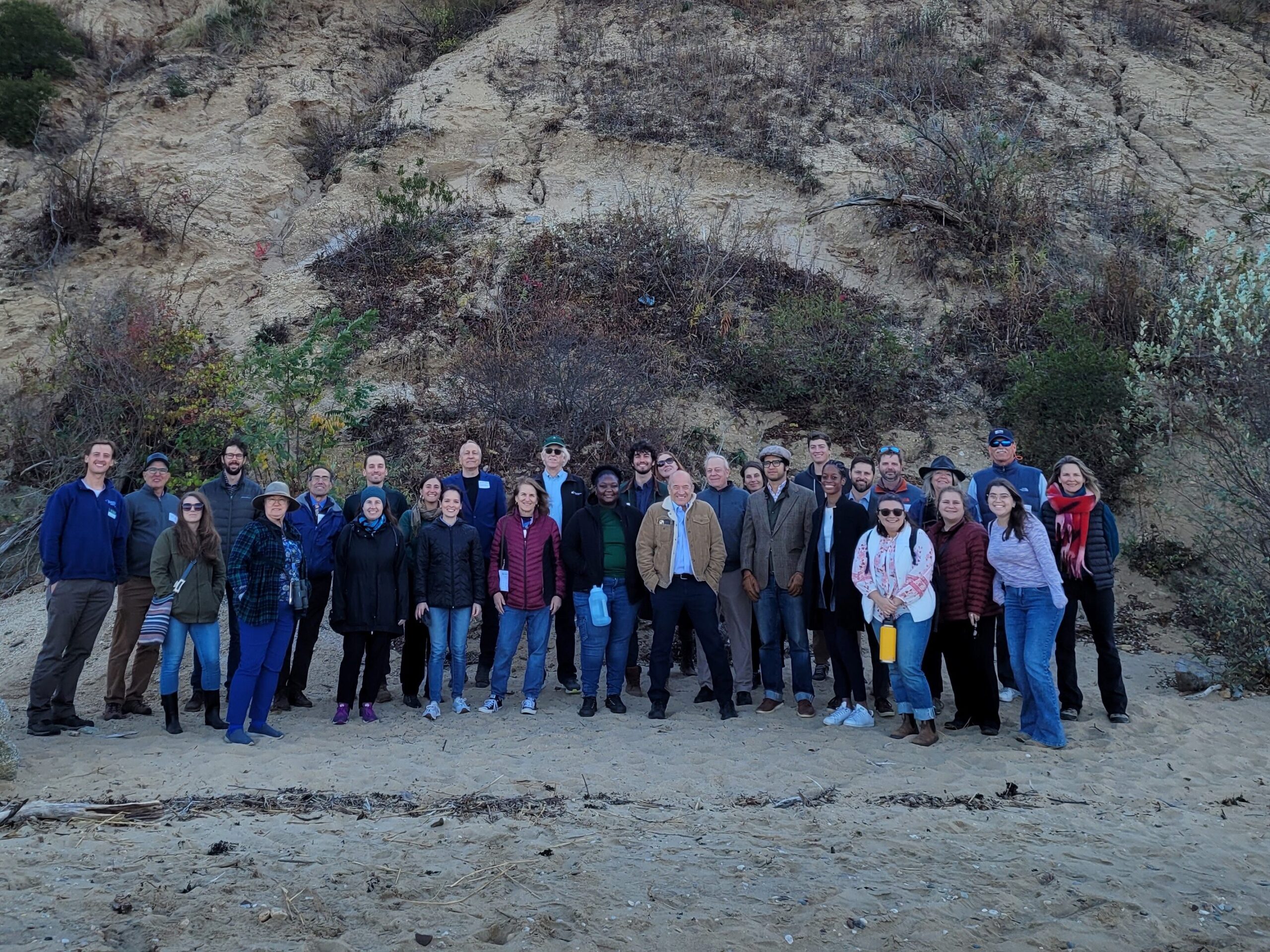
Suffolk County Coastal Resilience Forum & Field Trip – 2025
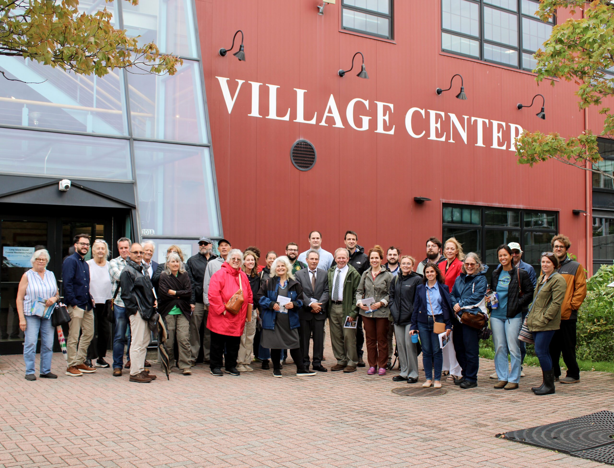
On October 8, 2025 state and local decision makers, municipal staff, and other interested parties working to address flooding, shoreline erosion and other coastal issues gathered at the Port Jefferson Village Center in Port Jefferson, NY for the 3rd Annual Suffolk County Coastal Resilience Forum. The Forum provided a chance to share information on best practices, discuss challenges, identify opportunities to increase resilience, and enhance coordination across communities. Forum attendees heard updates on State resilience initiatives from the NYS Department of Environmental Conservation and NYS Division of Homeland Security and Emergency Services, as well as presentations on new resilience tools and resources from Seatuck Environmental Association, the U.S. Geological Survey, New York Sea Grant, and Suffolk County Soil and Water Conservation District. In the afternoon, Village of Port Jefferson Mayor, Lauren Sheprow, presented on the Village’s resilience issues and initiatives and then led attendees on a walking tour of the Village highlighting flooding hotspots, challenges faced by local businesses and residents, and efforts to help mitigate flooding and increase community resilience.
The event was hosted by Long Island Sound Partnership and New York Sea Grant, in partnership with the Village of Port Jefferson and Suffolk County Soil and Water Conservation District.
Training
Suffolk County Coastal Resilience Forum & Field Trip – 2025
On October 8, 2025 state and local decision makers, municipal staff, and other interested parties working to address flooding, shoreline erosion and other coastal issues gathered at the Port Jefferson Village Center in Port Jefferson, NY for the 3rd Annual Suffolk County Coastal Resilience Forum. The Forum provided a chance to share information on best practices, discuss challenges, identify opportunities to increase resilience, and enhance coordination across communities. Forum attendees heard updates on State resilience initiatives from the NYS Department of Environmental Conservation and NYS Division of Homeland Security and Emergency Services, as well as presentations on new resilience tools and resources from Seatuck Environmental Association, the U.S. Geological Survey, New York Sea Grant, and Suffolk County Soil and Water Conservation District. In the afternoon, Village of Port Jefferson Mayor, Lauren Sheprow, presented on the Village’s resilience issues and initiatives and then led attendees on a walking tour of the Village highlighting flooding hotspots, challenges faced by local businesses and residents, and efforts to help mitigate flooding and increase community resilience.
The event was hosted by Long Island Sound Partnership and New York Sea Grant, in partnership with the Village of Port Jefferson and Suffolk County Soil and Water Conservation District.
Training
Nassau County Coastal Resilience Forum & Field Trip – 2025
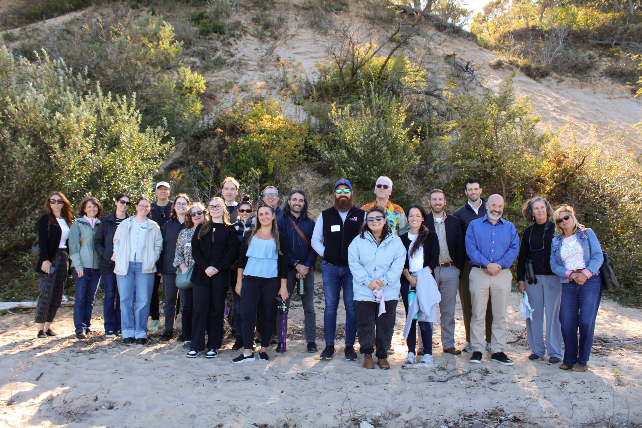
2025 Nassau Coastal Resilience Forum field trip to Sands Point Preserve. Credit: Sumayyah Uddin / NYSG
On October 9, 2025 state and local decision makers, municipal staff, and other interested parties working to address flooding, shoreline erosion and other coastal issues gathered at the Sands Point Preserve Conservancy in Sands Point, NY for the 3rd Annual Nassau County Coastal Resilience Forum. The Forum provided a chance to share information on best practices, discuss challenges, identify opportunities to increase resilience, and enhance coordination across communities. Forum attendees heard updates on State resilience initiatives from agencies like the NYS Department of Environmental Conservation and NYS Division of Homeland Security and Emergency Services, as well as presentations on new resilience tools and resources from Seatuck Environmental Association, the U.S. Geological Survey, New York Sea Grant, Cornell Cooperative Extension of Nassau County, and Nassau County Soil and Water Conservation District. In the afternoon, Forum attendees were given a guided tour of the recent expansions to the bluff stabilization project at the Preserve.
The event was hosted by Long Island Sound Partnership and New York Sea Grant, in partnership with the Sands Point Preserve Conservancy and Nassau and Suffolk County Soil and Water Conservation Districts.
Training
Nassau County Coastal Resilience Forum & Field Trip – 2025
2025 Nassau Coastal Resilience Forum field trip to Sands Point Preserve. Credit: Sumayyah Uddin / NYSG
On October 9, 2025 state and local decision makers, municipal staff, and other interested parties working to address flooding, shoreline erosion and other coastal issues gathered at the Sands Point Preserve Conservancy in Sands Point, NY for the 3rd Annual Nassau County Coastal Resilience Forum. The Forum provided a chance to share information on best practices, discuss challenges, identify opportunities to increase resilience, and enhance coordination across communities. Forum attendees heard updates on State resilience initiatives from agencies like the NYS Department of Environmental Conservation and NYS Division of Homeland Security and Emergency Services, as well as presentations on new resilience tools and resources from Seatuck Environmental Association, the U.S. Geological Survey, New York Sea Grant, Cornell Cooperative Extension of Nassau County, and Nassau County Soil and Water Conservation District. In the afternoon, Forum attendees were given a guided tour of the recent expansions to the bluff stabilization project at the Preserve.
The event was hosted by Long Island Sound Partnership and New York Sea Grant, in partnership with the Sands Point Preserve Conservancy and Nassau and Suffolk County Soil and Water Conservation Districts.
Training
Land Use Leadership Alliance (LULA) Training Program – Spring 2025
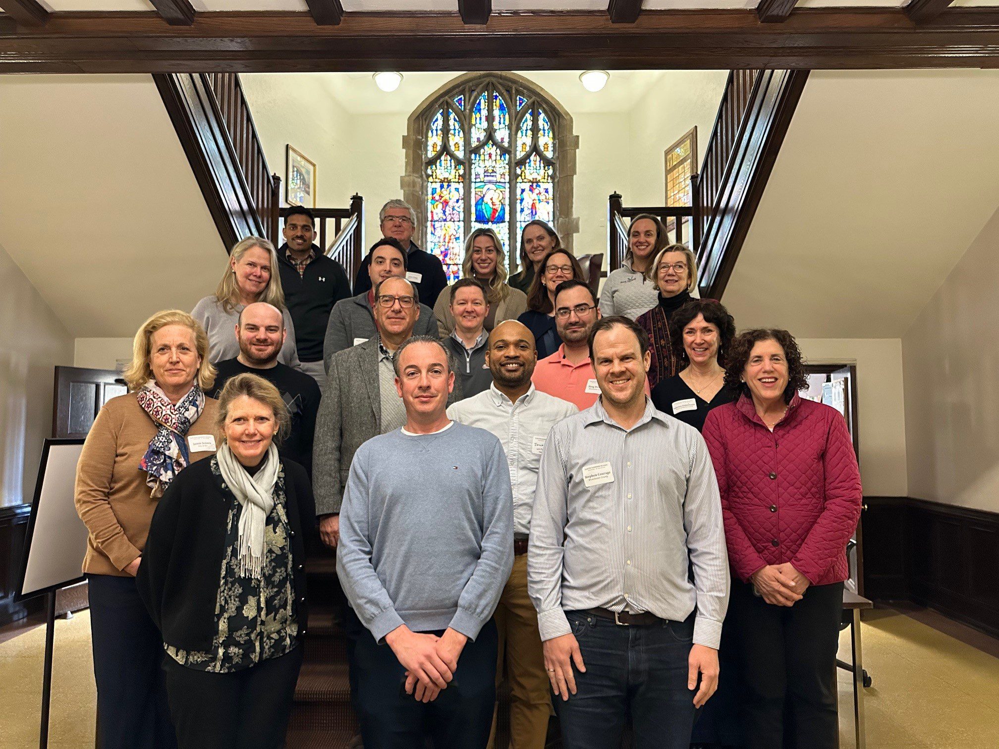
With funding from Long Island Sound Study and support from New York Sea Grant’s Sustainable and Resilient Communities Extension Professionals, Pace University’s Land Use Law Center brought its award-winning Land Use Leadership Alliance Training Program to Westchester municipalities within the Long Island Sound watershed. The training consisted of three full-day workshops held April 1, 8, and 22, 2025 in White Plains, NY to train local leaders on developing balanced strategies for effectively accomplishing policy objectives, particularly focused on land use, flood resilience, and natural resource protection to strengthen community planning and informed decision-making.
22 municipal staff and community leaders, representing 7 different Long Island Sound communities received resilience gap analyses that reviewed their municipality’s current zoning and comprehensive plan language, discussed common issues with their neighbors and built new networks of support, and graduated from the program empowered to plan for a more resilient future for their community and the Long Island Sound region.
If you are interested in learning more and participating in a future LULA training, please email lisresilience@gmail.com.
Training
Land Use Leadership Alliance (LULA) Training Program – Spring 2025
With funding from Long Island Sound Study and support from New York Sea Grant’s Sustainable and Resilient Communities Extension Professionals, Pace University’s Land Use Law Center brought its award-winning Land Use Leadership Alliance Training Program to Westchester municipalities within the Long Island Sound watershed. The training consisted of three full-day workshops held April 1, 8, and 22, 2025 in White Plains, NY to train local leaders on developing balanced strategies for effectively accomplishing policy objectives, particularly focused on land use, flood resilience, and natural resource protection to strengthen community planning and informed decision-making.
22 municipal staff and community leaders, representing 7 different Long Island Sound communities received resilience gap analyses that reviewed their municipality’s current zoning and comprehensive plan language, discussed common issues with their neighbors and built new networks of support, and graduated from the program empowered to plan for a more resilient future for their community and the Long Island Sound region.
If you are interested in learning more and participating in a future LULA training, please email lisresilience@gmail.com.
Training
This field trip was part of a Community Resilience Project Showcase leading up to the 2024 Annual SRC Workshop.
Hamden Bioretention Project Tour & Workshop
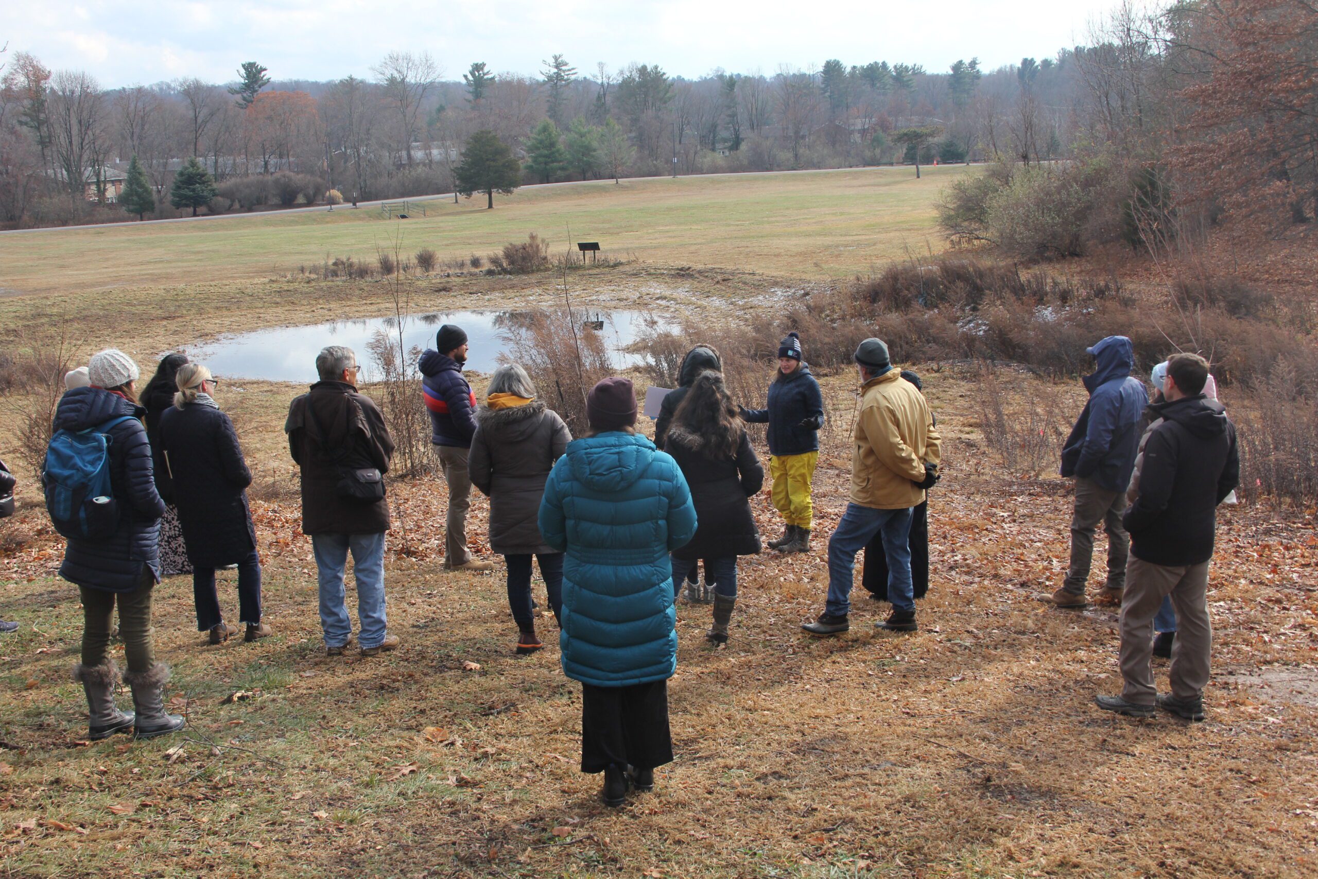 On December 5, 2024, the Sustainable and Resilient Communities (SRC) team of the Long Island Sound Study hosted a field trip featuring the Town of Hamden’s Bioretention Project – the largest municipally owned rain garden in the state! Participants began with a guided tour of the rain garden and bioretention areas at Town Center Park, where they heard from project planners and managers about its history, partnerships, challenges, and maintenance. Following this, participants gathered at the Hamden Government Center for a working lunch and presentations on topics including UConn’s Stormwater Corps, native plants, project engineering, and using nature-based solutions to advance climate resilience goals. The day concluded with a lively group discussion. Special thanks to our partners with the Town of Hamden, Save the Sound, the Hamden Land Trust, and UConn Extension.
Photo credit: Judy Benson
Training
This field trip was part of a Community Resilience Project Showcase leading up to the 2024 Annual SRC Workshop.
Hamden Bioretention Project Tour & Workshop
On December 5, 2024, the Sustainable and Resilient Communities (SRC) team of the Long Island Sound Study hosted a field trip featuring the Town of Hamden’s Bioretention Project – the largest municipally owned rain garden in the state! Participants began with a guided tour of the rain garden and bioretention areas at Town Center Park, where they heard from project planners and managers about its history, partnerships, challenges, and maintenance. Following this, participants gathered at the Hamden Government Center for a working lunch and presentations on topics including UConn’s Stormwater Corps, native plants, project engineering, and using nature-based solutions to advance climate resilience goals. The day concluded with a lively group discussion. Special thanks to our partners with the Town of Hamden, Save the Sound, the Hamden Land Trust, and UConn Extension.
Photo credit: Judy Benson
Training
3rd Annual SRC Workshop: Session 2 – Resilience Tools
The Long Island Sound Sustainable and Resilient Communities (SRC) Team held our 2024 Annual Workshop virtually as three sessions over two days. Session topics focused on our assistance programs, new regional resilience resources and tools, and a discussion on planning for inundation and different considerations communities may face.
Session 2 – Resilience Tools was held on Tuesday, December 10th from 1:30-3:30 PM. Participants learned about new Resilience Tools being developed and used throughout coastal Long Island Sound.
Training
3rd Annual SRC Workshop: Session 1 – SRC Resilience Assistance Programs
The Long Island Sound Sustainable and Resilient Communities (SRC) Team held our 2024 Annual Workshop virtually as three sessions over two days. Session topics focused on our assistance programs, new regional resilience resources and tools, and a discussion on planning for inundation and different considerations communities may face.
Session 1 – SRC Resilience Assistance Programs was held on Tuesday, December 10th from 10-11:30 AM. Participants learned about our Sustainable and Resilient Communities resilience assistance programs and heard from communities who have successfully utilized them to advance resilience project plans, build capacity, and secure competitive grant funding!
Training
Nassau County Coastal Resilience Forum & Field Trip – 2024
2024 Nassau Coastal Resilience Forum field trip to Sands Point Preserve. Credit: NYSG
On October 28, 2024, state and local decision makers, municipal staff, and other interested parties working to address coastal issues gathered at the Sands Point Preserve Conservancy in Sands Point, NY for the 2nd Annual Nassau County Coastal Resilience Forum to identify opportunities to increase resilience, learn about best practices, and enhance coordination across communities. There were presentations on the Long Island Sound Resilience Resource Hub & Assistance Programs, NYSDEC Office of Climate Change updates, marsh conservation planning, bluff management and restoration, and nature-based solutions to increase shoreline resilience. There was also a guided walking tour of the resilience projects at Sands Point Preserve.
The event is hosted by Long Island Sound Study and New York Sea Grant, in partnership with the Sands Point Preserve Conservancy and Nassau and Suffolk Soil and Water Conservation Districts.
Training
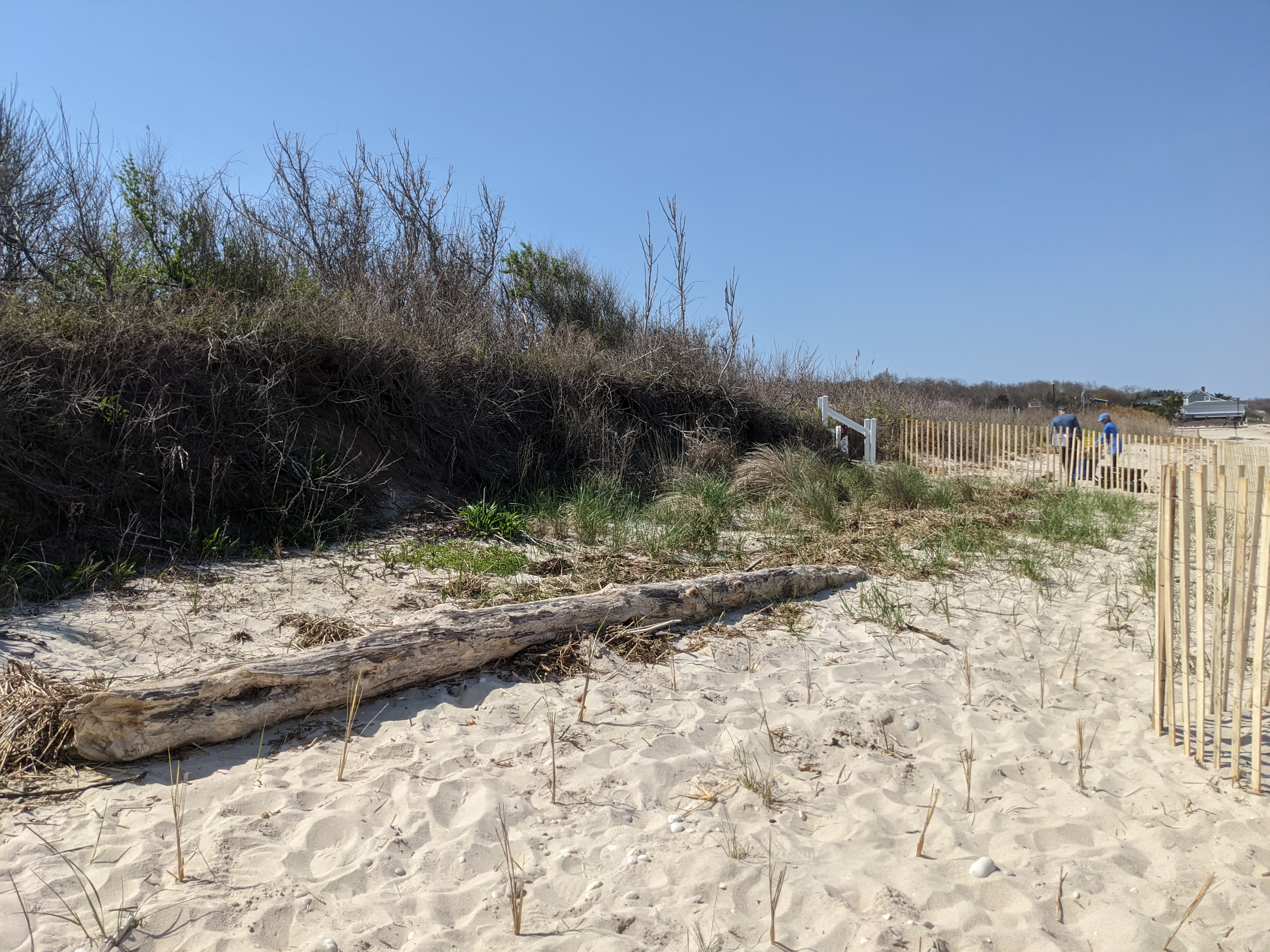
Suffolk County Coastal Resilience Forum & Field Trip
On October 29, 2024, state and local decision makers, municipal staff, and other interested parties working to address coastal issues gathered at the Dorothy P. Flint 4-H Camp in Riverhead, NY to identify opportunities to increase resilience, learn about best practices, and enhance coordination across communities. There were presentations on the Long Island Sound Resilience Resource Hub, NYSDEC Climate Office updates, marsh conservation planning, bluff management and restoration, and nature-based solutions to increase shoreline resilience. There was also a field trip to Iron Pier Beach/Maidstone Landing to view and learn about a community bluff restoration project.
This event was hosted by Long Island Sound Study and New York Sea Grant, in partnership with Nassau and Suffolk Soil and Water Conservation Districts, Nassau CCE, and Maidstone Landing.
Training
SRC Annual Bi-State Workshop 2023
The second annual Long Island Sound Bi-State Sustainable and Resilient Communities Workshop brought together nearly 200 people virtually on Dec. 7, 2023 to learn about a new Long Island Sound Resilience Resource Hub (launching in early 2024), hear from communities and groups around the Sound working on resilience planning, and consider pathways for updating codes and ordinances. Videos of the workshop’s six sessions are available on YouTube. They can be accessed below along with supporting documents.
Training
SRC Annual Bi-State Workshop 2022
The first annual Long Island Sound Bi-State Sustainable and Resilient Communities Workshop brought together more than 260 people virtually on Dec. 1, 2022 to learn about opportunities to increase the resilience of the Sound’s communities to climate change and other environmental threats. Interactive sessions included opportunities to learn more about the SRC Extension Professionals’ needs assessment findings and recommendations, the newly released Long Island Sound Resilience Grant Writing Assistance Program, and tips for success with Long Island Sound funding opportunities. Concurrent breakout sessions highlighted the work of partners related to shoreline planning and implementation, using green infrastructure for stormwater management, sustainable climate planning for relocation, and new sustainability/resilience tools available in both New York and Connecticut. Videos of the workshop’s six sessions are available on YouTube. They can be accessed below along with supporting documents.
Training
Reimagining Long Island Lawns: Eco-Friendly Practices
On July 18th, 2023 NYS Department of Environmental Conservation and NY Sea Grant hosted a free public webinar to share more about what steps homeowners can take in their own yards to protect and improve Long Island waters! Featured experts from New York Sea Grant, NYS Department of Environmental Conservation, Long Island Commission for Aquifer Protection, Cornell Cooperative Extension Suffolk County, and Rewild Long Island discussed smart fertilizer practices, water conservation, and native plantings.
Training
Steps to Resilience
This online information session held Sept. 19, and repeated Sept. 21, provides an introduction to resilience planning in the Long Island Sound region. It includes discussions on local climate impacts and projections, resilience planning strategies, and climate certification programs for both New York and Connecticut municipalities. In addition to the main presentation, videos of the Connecticut and New York breakout sessions can be accessed below. The presentations and other resource materials are available here.
Case Study
Project
Hamden, CT
Town of Hamden’s Bioretention Project
The Town of Hamden’s Bioretention Project is the largest municipally owned rain garden in the state! Save the Sound, in partnership with the Town of Hamden, completed this large-scale rain garden project at Hamden Town Center Park to improve local water quality, restore habitat, and enhance community resilience. The project transformed approximately 2.5 acres of lawn into a functioning green infrastructure system that now manages runoff from an 88-acre urban watershed draining Dixwell Avenue and surrounding neighborhoods. Prior to the project, stormwater often overflowed directly into Pardee Brook and the Mill River, carrying pollutants and inundating the park.
The newly constructed rain garden was engineered with layers of soil, sand, and rock, and planted with more than 7,000 native grasses, flowers, and shrubs thanks to additional support from the Land Trust of Hamden. These plantings naturally filter pollutants such as fertilizers, road salt, and chemicals. Community volunteers helped complete the planting, strengthening local stewardship in the Town of Hamden.


A 40,000 sq ft rain garden was installed and included restoration of an acre of park land. The system now treats over 20 million gallons of stormwater annually, reducing flooding and restoring more natural hydrology to Shepard Brook and the Mill River. Beyond its environmental benefits, the project created valuable wildlife habitat and a welcoming green space for residents to enjoy. Adaptive management, more planting, and stewardship is planned for 2025 and 2026.
Nicole Davis, Save the Sound
Jim Sirch, Hamden Land Conservation Trust
Stephen White, PE, Town of Hamden Engineer/LTA
Case Study
Project
Hamden, CT
Town of Hamden’s Bioretention Project
The Town of Hamden’s Bioretention Project is the largest municipally owned rain garden in the state! Save the Sound, in partnership with the Town of Hamden, completed this large-scale rain garden project at Hamden Town Center Park to improve local water quality, restore habitat, and enhance community resilience. The project transformed approximately 2.5 acres of lawn into a functioning green infrastructure system that now manages runoff from an 88-acre urban watershed draining Dixwell Avenue and surrounding neighborhoods. Prior to the project, stormwater often overflowed directly into Pardee Brook and the Mill River, carrying pollutants and inundating the park.
The newly constructed rain garden was engineered with layers of soil, sand, and rock, and planted with more than 7,000 native grasses, flowers, and shrubs thanks to additional support from the Land Trust of Hamden. These plantings naturally filter pollutants such as fertilizers, road salt, and chemicals. Community volunteers helped complete the planting, strengthening local stewardship in the Town of Hamden.
Case Study
Project
Halesite, NY
Halesite Park Shoreline Restoration
With support from the Long Island Sound Resilience Grant Writing Assistance Program, in December 2024 1653 Foundation was awarded $549,955 from the NYSDEC Water Quality Improvement Project (WQIP) Program to fund the Final design and implementation of habitat improvements and green infrastructure at Halesite Park, NY.
1653 Foundation Inc. will restore degrading shoreline at Halesite Park on the eastern shore of Huntington Harbor. The project will remove a failing seawall to expand shallow water habitat, install an offshore rock sill and oyster reef, and expand salt marsh vegetation, and upland plantings.
LIS Resilience Grant Writing Assistance Program Details:
Grant Writing Consultant: DLB Planning, LLC.
Grant Writing Assistance Award: $9,900
GWA Case Study
Project
Mystic, CT
Mystic River Watershed Resilience Action Plan
With support from the Long Island Sound Resilience Grant Writing Assistance (GWA) Program, in December 2024 the Alliance for the Mystic River Watershed was awarded $419,900 from the Long Island Sound Futures Fund to support the project: Developing a Mystic River Watershed Resilience Action Plan Using Equitable Community Engagement, CT.
The project will launch a robust engagement effort and planning process throughout four municipalities and two Tribal Nations within Mystic, Connecticut, in order to initiate efforts to improve the watershed health along the 30.6-square-mile Mystic River Watershed. The project will develop a community- and stakeholder-supported EPA Nine Element watershed-based plan, which will strive to address water quality impairments, community inequities and resilience challenges in the watershed.
LIS Resilience Grant Writing Assistance Program Details:
Grant Writing Consultant: Resilient Land and Water, LLC.
Grant Writing Assistance Award: $9,950

Maggie Favretti, President & Chair Board of Directors, Alliance for the Mystic River Watershed, info@alliancemrw.org
GWA Case Study
Project
Mystic, CT
Mystic River Watershed Resilience Action Plan
With support from the Long Island Sound Resilience Grant Writing Assistance (GWA) Program, in December 2024 the Alliance for the Mystic River Watershed was awarded $419,900 from the Long Island Sound Futures Fund to support the project: Developing a Mystic River Watershed Resilience Action Plan Using Equitable Community Engagement, CT.
The project will launch a robust engagement effort and planning process throughout four municipalities and two Tribal Nations within Mystic, Connecticut, in order to initiate efforts to improve the watershed health along the 30.6-square-mile Mystic River Watershed. The project will develop a community- and stakeholder-supported EPA Nine Element watershed-based plan, which will strive to address water quality impairments, community inequities and resilience challenges in the watershed.
LIS Resilience Grant Writing Assistance Program Details:
Grant Writing Consultant: Resilient Land and Water, LLC.
Grant Writing Assistance Award: $9,950
Case Study
Project
Fairfield, CT
Mill River Wetland Committee’s River-Lab programs in Bridgeport, CT
With support from the Long Island Sound Resilience Grant Writing Assistance (GWA) Program, in 2024 the Mill River Wetland Committee (MRWC) was awarded $26,987 from the Long Island Sound Community Impact Fund to support MRWC to lead the 5th Grade classes (2) at Barnum School in Bridgeport, CT through the Groundwater Study Trip in the fall of 2024 and Water Monitoring training in the spring of 2025.
LIS Resilience Grant Writing Assistance Program Details:
Grant Writing Consultant: CT Grant Writers
Grant Writing Assistance Award: $1,912.50
Case Study
Project
Nassau & Suffolk County, NY
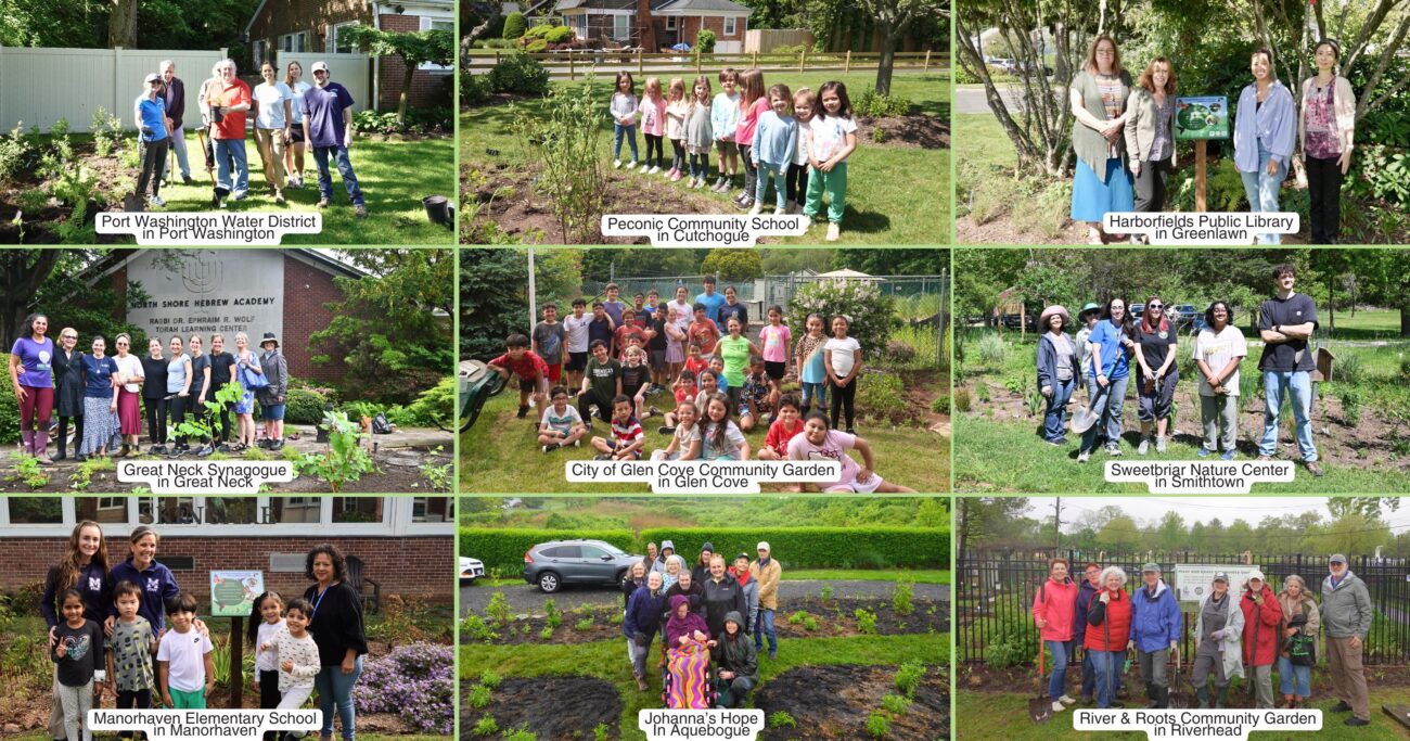
ReWild Long Island Community Gardens Program
With support from the Long Island Sound Resilience Grant Writing Assistance (GWA) Program, in December 2023 ReWild Long Island was awarded $230,300 from the Long Island Sound Futures Fund to fund the project – ReWild Gardens for Long Island Sound: Implementation of an expanded community garden program Long Island within the LISS watershed.
The Community Gardens Program installs native plant gardens with community partners who plant & maintain them. The Summer Program to Fight Hunger and Climate Change supports high school students to plant & tend gardens with local nonprofit partners.
LIS Resilience Grant Writing Assistance Program Details:
Grant Writing Consultant: Elizabeth Skolnick
Grant Writing Assistance Award: $7,500
Case Study
Project
Nassau & Suffolk County, NY
ReWild Long Island Community Gardens Program
With support from the Long Island Sound Resilience Grant Writing Assistance (GWA) Program, in December 2023 ReWild Long Island was awarded $230,300 from the Long Island Sound Futures Fund to fund the project – ReWild Gardens for Long Island Sound: Implementation of an expanded community garden program Long Island within the LISS watershed.
The Community Gardens Program installs native plant gardens with community partners who plant & maintain them. The Summer Program to Fight Hunger and Climate Change supports high school students to plant & tend gardens with local nonprofit partners.
LIS Resilience Grant Writing Assistance Program Details:
Grant Writing Consultant: Elizabeth Skolnick
Grant Writing Assistance Award: $7,500
Case Study
Project
Cold Spring Harbor, NY
North Shore Land Alliance Shore Road Sanctuary Habitat Restoration Project
With support from the Long Island Sound Resilience Grant Writing Assistance (GWA) Program, in December 2023, North Shore Land Alliance was awarded $192,969 from the NYSDEC Water Quality Improvement Project (WQIP) Program to fund the implementation of green infrastructure at the North Shore Land Alliance Shore Road Sanctuary in Cold Spring Harbor, NY. The North Shore Land Alliance will install an upland infiltration system to reduce the volume and velocity of stormwater on a 40-acre parcel and replace invasive plants along the shoreline with a native plant community. The project will restore habitat and reduce the amount stormwater and pollutants entering Cold Spring Harbor and Long Island Sound.
LIS Resilience Grant Writing Assistance Program Details:
Grant Writing Consultant: Nelson Pope & Voorhis
Grant Writing Assistance Award: $9,900

Jane Jackson, Director of Stewardship, North Shore Land Alliance, jjackson@northshorelandalliance.org
Case Study
Project
Cold Spring Harbor, NY
North Shore Land Alliance Shore Road Sanctuary Habitat Restoration Project
With support from the Long Island Sound Resilience Grant Writing Assistance (GWA) Program, in December 2023, North Shore Land Alliance was awarded $192,969 from the NYSDEC Water Quality Improvement Project (WQIP) Program to fund the implementation of green infrastructure at the North Shore Land Alliance Shore Road Sanctuary in Cold Spring Harbor, NY. The North Shore Land Alliance will install an upland infiltration system to reduce the volume and velocity of stormwater on a 40-acre parcel and replace invasive plants along the shoreline with a native plant community. The project will restore habitat and reduce the amount stormwater and pollutants entering Cold Spring Harbor and Long Island Sound.
LIS Resilience Grant Writing Assistance Program Details:
Grant Writing Consultant: Nelson Pope & Voorhis
Grant Writing Assistance Award: $9,900
Case Study
Plan
East Haddam, CT
East Haddam Community Resilience Building Summary of Findings
With support from the Nature Conservancy and Sustainable CT, East Haddam organized a Community Resilience Building process and workshop, the results of which were compiled into this summary. The team engaged with community members to determine the present hazards and vulnerabilities and identify resilient solutions.
Case Study
Project
Rain Gardens on Western Waterfront
Friends of the Bay installed two raingardens at the Western Waterfront, which was done in October 2021 with the help of volunteers.


The main ways Friends of the Bay measured outcomes was by observing the absorption of water into the gardens after rain storms and seeing pollinators just a day or two after planting. The biggest benefit though was the engagement by the Town of Oyster Bay in fixing another rain garden at the Western Waterfront with help from a grant they received as well as plans to install more rain gardens in the area. Friends of the Bay was also able to engage a corps. of dedicated volunteers from the community. The long-term impact of the work is the continuation of stormwater runoff mitigation to the bay.
Friends of the Bay, info@friendsofthebay.org
Case Study
Project
Rain Gardens on Western Waterfront
Friends of the Bay installed two raingardens at the Western Waterfront, which was done in October 2021 with the help of volunteers.
Case Study
Project
Sea Cliff, NY
Scudders Pond Subwatershed Improvements
The Hempstead Harbor Protection Committee and Village of Sea Cliff completed subwatershed improvements at Scudders Pond to address stormwater drainage problems impacting the water quality of the pond and Hempstead Harbor, highlighted as a priority in the 1998 Hempstead Harbor Water Quality Improvement Plan. The improvements included dredging the pond, installing a hydrodynamic separator to intercept sediment, removing invasive Phragmites australis and replacing with native plants, realigning the stream to reduce erosion, redirecting the stormwater from residences to the bioswale, creation of a biofilter wetland area, replacement of the weir between the upper and lower ponds and weir at Shore Road.

Water quality improvements in Scudders Pond and Hempstead Harbor, views of the Pond have been restored.
Eric Swenson, Hempstead Harbor Protection Committee, hempsteadharbor@gmail.com
Case Study
Project
Sea Cliff, NY
Scudders Pond Subwatershed Improvements
The Hempstead Harbor Protection Committee and Village of Sea Cliff completed subwatershed improvements at Scudders Pond to address stormwater drainage problems impacting the water quality of the pond and Hempstead Harbor, highlighted as a priority in the 1998 Hempstead Harbor Water Quality Improvement Plan. The improvements included dredging the pond, installing a hydrodynamic separator to intercept sediment, removing invasive Phragmites australis and replacing with native plants, realigning the stream to reduce erosion, redirecting the stormwater from residences to the bioswale, creation of a biofilter wetland area, replacement of the weir between the upper and lower ponds and weir at Shore Road.
Case Study
Project
Norwalk, CT
Webster Street Parking Lot Green Infrastructure Project
In 2019, the City of Norwalk secured a LIS Future Fund grant to install green infrastructure in the Webster Street Parking to reduce the impacts of stormwater on the Norwalk River and Harbor and mitigate local flooding of surrounding businesses through the installation of four different types of infiltration and bio-retention structures:
1) Underground infiltration systems.
2) Retention basins and curb inlet planters in eight different areas.
3) Porous pavement with storage in two areas.
4) Infiltration gutters and tree filters in two other areas.
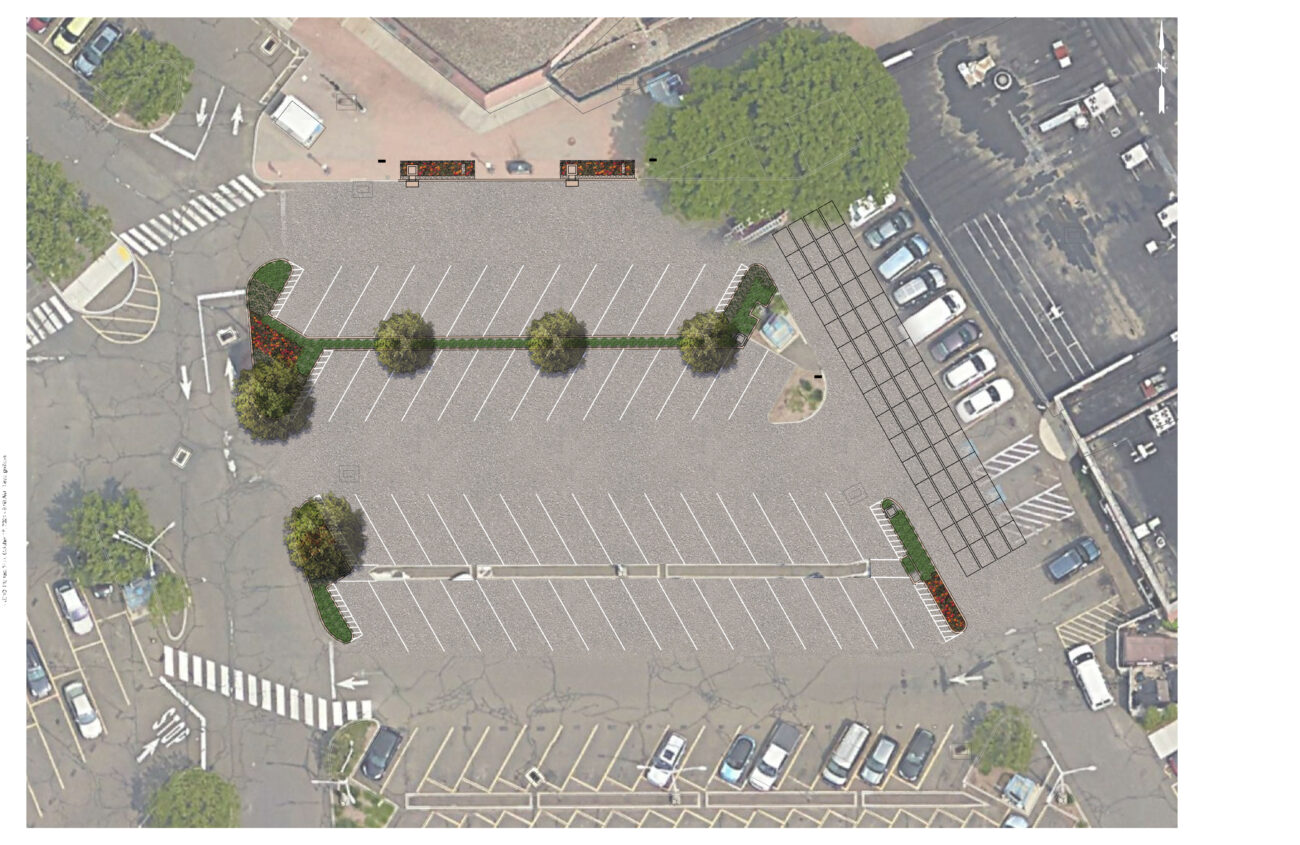


The project is estimated to remove 12 lbs. of nitrogen and preventing over 6 million gallons of stormwater from entering Norwalk Harbor annually. Since it’s installation, the site has not experienced any flooding incidents (as of 2024), indicating that it seems to be functioning well.
Bryan Lutz
Assistant Director of Parking
blutz@norwalkct.gov; 203-854-7253
Case Study
Project
Norwalk, CT
Webster Street Parking Lot Green Infrastructure Project
In 2019, the City of Norwalk secured a LIS Future Fund grant to install green infrastructure in the Webster Street Parking to reduce the impacts of stormwater on the Norwalk River and Harbor and mitigate local flooding of surrounding businesses through the installation of four different types of infiltration and bio-retention structures:
1) Underground infiltration systems.
2) Retention basins and curb inlet planters in eight different areas.
3) Porous pavement with storage in two areas.
4) Infiltration gutters and tree filters in two other areas.
Case Study
Project
New Haven, CT
New Haven Bioswales
The City of New Haven has installed 286 right-of-way bioswales throughout the city as part of a multifaceted approach to reducing flooding in the downtown area. Right-of-way bioswales are engineered planted areas that are located on sidewalks. They are designed to capture and infiltrate stormwater into the ground that would otherwise directly enter a storm drain. These bioswales were installed as the result of various partnerships and funding opportunities related to flood prevention, localized drainage solutions, combined sewer overflow mitigation, research, and traffic calming projects.
Project Lead
City of New Haven, Dept of Engineering
Project Partners
Urban Resources Initiative, EMERGE Inc., Save the Sound, Yale School of the Environment, and Quinnipiac University, among others.


Monitoring performed by Yale School of the Environment researchers (led by Prof. Gaboury Benoit) have demonstrated that the bioswales have captured 70-75% of stormwater runoff in two locations. These results indicate that the bioswales are highly effective in diverting stormwater and thus, preventing pollution.
Dawn Henning
dhenning@newhavenct.gov
475-434-1643
Case Study
Project
New Haven, CT
New Haven Bioswales
The City of New Haven has installed 286 right-of-way bioswales throughout the city as part of a multifaceted approach to reducing flooding in the downtown area. Right-of-way bioswales are engineered planted areas that are located on sidewalks. They are designed to capture and infiltrate stormwater into the ground that would otherwise directly enter a storm drain. These bioswales were installed as the result of various partnerships and funding opportunities related to flood prevention, localized drainage solutions, combined sewer overflow mitigation, research, and traffic calming projects.
Project Lead
City of New Haven, Dept of Engineering
Project Partners
Urban Resources Initiative, EMERGE Inc., Save the Sound, Yale School of the Environment, and Quinnipiac University, among others.